
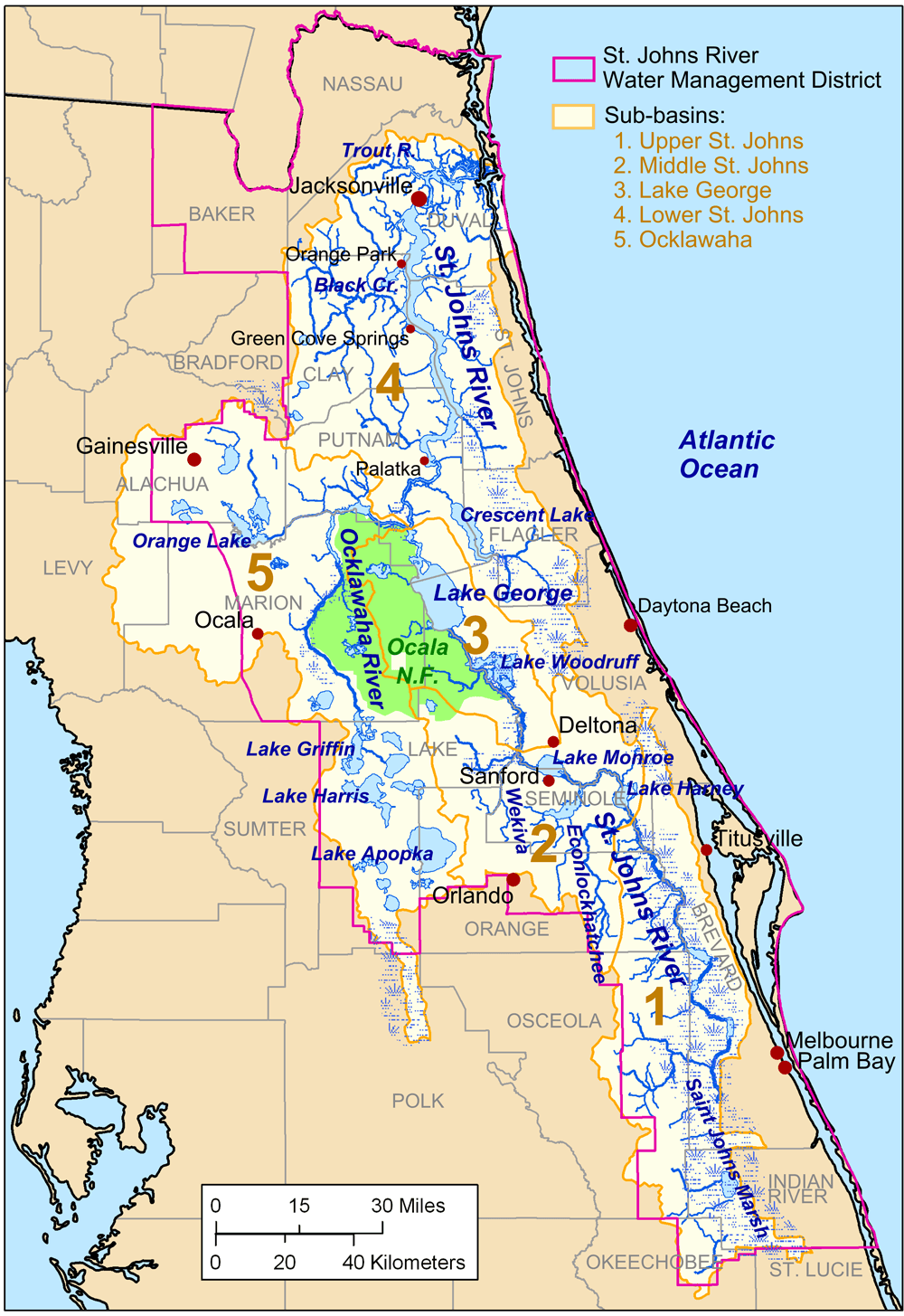
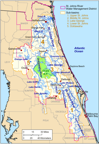
Image: Stjohnsriver detailmap
Size of this preview: 412 × 599 pixels. Other resolutions: 165 × 240 pixels | 1,000 × 1,455 pixels.
Original image (1,000 × 1,455 pixels, file size: 890 KB, MIME type: image/png)
Description: Map of the w:St. Johns River drainage basin.
Title: Stjohnsriver detailmap
Credit: Own work. City, county, and drainage basin data source: National Atlas[1]. Hydrology data source: National Hydrography Dataset [2]. St. Johns River Management District boundary source: St. Johns River Management District [3].
Author: Kmusser
Usage Terms: Creative Commons Attribution-Share Alike 3.0
License: CC BY-SA 3.0
License Link: https://creativecommons.org/licenses/by-sa/3.0
Attribution Required?: Yes
Image usage
The following page links to this image:

All content from Kiddle encyclopedia articles (including the article images and facts) can be freely used under Attribution-ShareAlike license, unless stated otherwise.