
Image: Strait of Gibraltar perspective
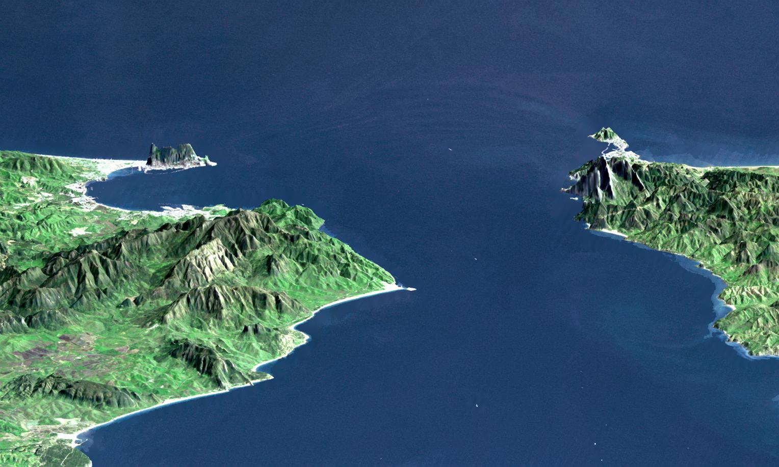
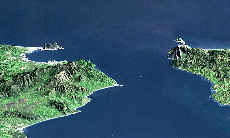
Description: "This perspective view shows the Strait of Gibraltar, which is the entrance to the Mediterranean Sea from the Atlantic Ocean, with a 3-times vertical exaggeration to enhance topographic expression. Europe (Spain) is on the left. Africa (Morocco) is on the right. The Rock of Gibraltar, administered by Great Britain, is the peninsula in the back left." (quotation taken from the more detailed NASA description page) View Size: 46 kilometers (28 miles) wide, 106 kilometers (66 miles) distance Location: 36 degrees North latitude, 5.5 degrees West longitude Orientation: Looking East, 15 degrees down from horizontal, 3X vertical exaggeration Image Data: Landsat Bands 1, 2+4, 3 as blue, green, red respectively Original Data Resolution: 30 meters (99 feet)
Title: Strait of Gibraltar perspective
Credit: http://photojournal.jpl.nasa.gov/catalog/PIA03397
Author: NASA / JPL / NIMA
Usage Terms: Public domain
License: Public domain
Attribution Required?: No
Image usage
The following page links to this image:
