
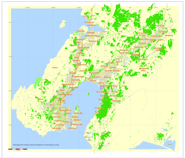
Image: Street map of Wellington city New Zealand Level 12

Size of this PNG preview of this SVG file: 703 × 599 pixels. Other resolution: 282 × 240 pixels.
Original image (SVG file, nominally 1,749 × 1,491 pixels, file size: 4.22 MB)
Description: Street map of Wellington city New Zealand Level 12 (5000 meters scale).
Title: Street map of Wellington city New Zealand Level 12
Credit: I draw vector maps Previously published: http://vectormap.info/free_vector_maps_downloads/free-printable-map-wellington-new-zealand-exact-vector-street-map-fully-editable-adobe-illustrator-adobe-pdf-svg-g-view-level-12-5000-meters-scale-full-vector/
Author: Ilya Shrayber
Usage Terms: Creative Commons Attribution-Share Alike 4.0
License: CC BY-SA 4.0
License Link: http://creativecommons.org/licenses/by-sa/4.0
Attribution Required?: Yes
Image usage
There are no pages that link to this image.

All content from Kiddle encyclopedia articles (including the article images and facts) can be freely used under Attribution-ShareAlike license, unless stated otherwise.