
Image: Stretford Road, Hulme - geograph.org.uk - 330182
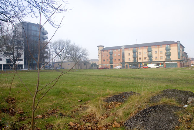
Description: Stretford Road, Hulme Hulme is an urban regeneration area. The flats on the left were put up in 2006, the building centre right houses a Post Office, take away, off-licence, pharmacist, and, round the corner, a doctors surgery. Between this block and the new flats is the Anglican Parish Church of the Ascension. The library is just up Stretford Road. The green space in the foreground acts as an unofficial park. A dark line running across the image is in fact a footpath. For as long as I have lived in Hulme (four and a half years) this has been used frequently as a public footpath and my understanding is that the practice has been going on for many years previously. For all that there is a road called 'Hulme High Street', this is probably the true centre of the community in Hulme.
Title: Stretford Road, Hulme - geograph.org.uk - 330182
Credit: From geograph.org.uk
Author: Marcus Hargis
Usage Terms: Creative Commons Attribution-Share Alike 2.0
License: CC BY-SA 2.0
License Link: http://creativecommons.org/licenses/by-sa/2.0
Attribution Required?: Yes
Image usage
The following page links to this image:
