
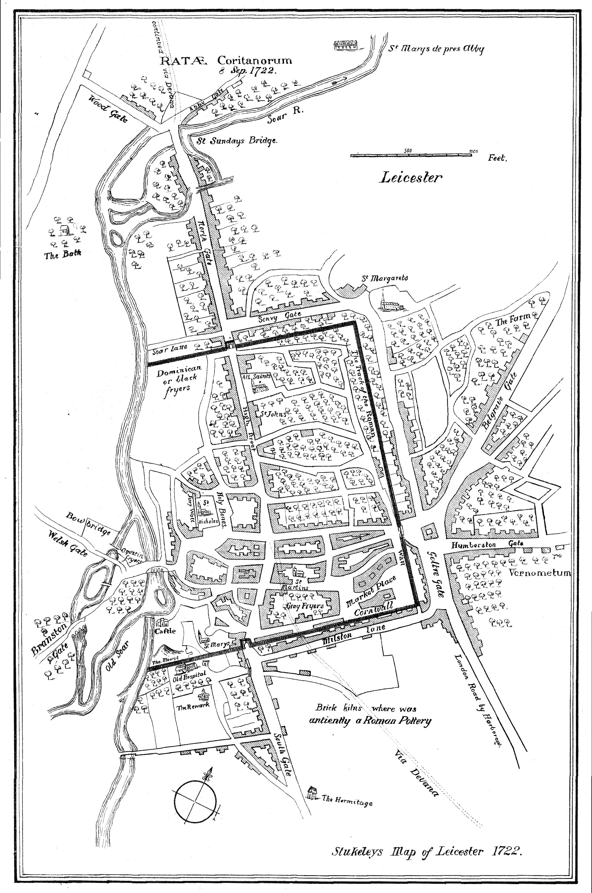
Image: Stukeley Leicester Map 1722
Size of this preview: 397 × 599 pixels. Other resolutions: 159 × 240 pixels | 2,059 × 3,105 pixels.
Original image (2,059 × 3,105 pixels, file size: 1.21 MB, MIME type: image/jpeg)
Description: William Stukeley's map of Leicester in 1722
Title: Stukeley Leicester Map 1722
Credit: Drawn 1722, reprinted in Glimpses of Ancient Leicester (1906) by Mrs T. Fielding Johnson.
Author: William Stukeley
Usage Terms: Public domain
License: Public domain
Attribution Required?: No
Image usage
The following 2 pages link to this image:

All content from Kiddle encyclopedia articles (including the article images and facts) can be freely used under Attribution-ShareAlike license, unless stated otherwise.