
Image: Syrdaryamap

Size of this preview: 719 × 600 pixels. Other resolutions: 288 × 240 pixels | 820 × 684 pixels.
Original image (820 × 684 pixels, file size: 936 KB, MIME type: image/png)
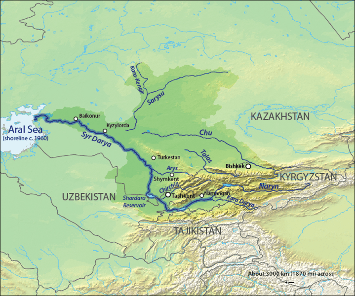
Description: Map of the Syr Darya Basin watershed, of the Syr Darya and Chu Rivers — in Central Asia. It runs in Kazakhstan, Tajikistan, and Uzbekistan, and drains into the endorheic Aral Sea.
Title: Syrdaryamap
Credit: Background and river course data from http://www2.demis.nl/mapserver/mapper.asp
Author: Background layer attributed to DEMIS Mapserver, map created by Shannon1
Permission: Map created from DEMIS Mapserver, which are public domain.
Usage Terms: Creative Commons Attribution-Share Alike 4.0
License: CC BY-SA 4.0
License Link: https://creativecommons.org/licenses/by-sa/4.0
Attribution Required?: Yes
Image usage
The following 2 pages link to this image:

All content from Kiddle encyclopedia articles (including the article images and facts) can be freely used under Attribution-ShareAlike license, unless stated otherwise.