
Image: Takahe distribution map

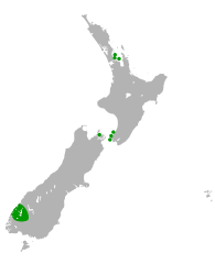
Description: Distribution map of the South Island takahe. Sanctuaries and small islands are shown by dots.
Title: Takahe distribution map
Credit: This file was derived from: Map of New Zealand (blank).svg by User:Antigoni. Distribution info from: http://www.doc.govt.nz/takahe http://nzbirdsonline.org.nz/species/south-island-takahe http://nzbirdsonline.org.nz/sites/all/files/PORHOC_FG.pdf Robertson, C.J., Hyvönen, P., Fraser, M.J., Pickard, C.R. (2007). "Atlas of Bird Distribution in New Zealand 1999-2004. The Ornithological Society of New Zealand.
Author: Air55
Usage Terms: Creative Commons Attribution-Share Alike 4.0
License: CC BY-SA 4.0
License Link: https://creativecommons.org/licenses/by-sa/4.0
Attribution Required?: Yes
Image usage
The following 2 pages link to this image:
