
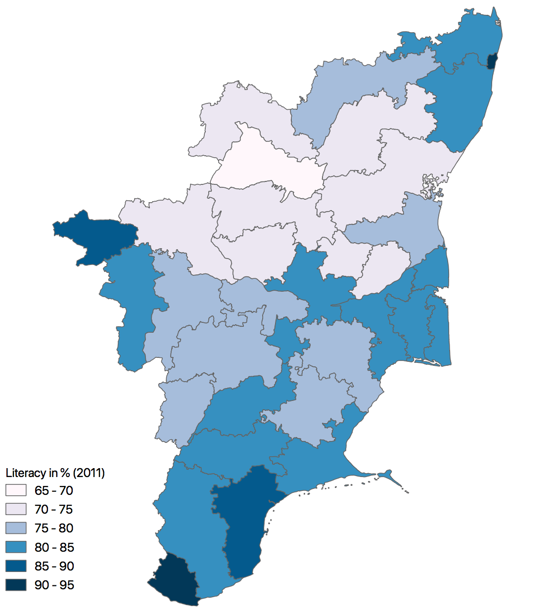
Image: Tamil Nadu Literacy Map 2011
Size of this preview: 542 × 599 pixels. Other resolutions: 217 × 240 pixels | 1,122 × 1,240 pixels.
Original image (1,122 × 1,240 pixels, file size: 235 KB, MIME type: image/png)
Description: A Choropleth map of Tamilnadu state, India, showing the district wise literacy rate in 2011.
Title: Tamil Nadu Literacy Map 2011
Credit: This was created using the GADM vector data and 2011 Census provisional totals using QGIS. Refer data here
Author: Arunmozhi
Usage Terms: Creative Commons Attribution-Share Alike 3.0
License: CC BY-SA 3.0
License Link: http://creativecommons.org/licenses/by-sa/3.0
Attribution Required?: Yes
Image usage
There are no pages that link to this image.

All content from Kiddle encyclopedia articles (including the article images and facts) can be freely used under Attribution-ShareAlike license, unless stated otherwise.