
Image: Tampabaymetro
No higher resolution available.
Tampabaymetro.png (400 × 400 pixels, file size: 24 KB, MIME type: image/png)
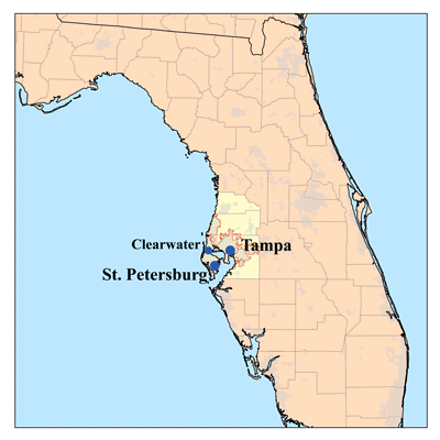
Description: This is a map of the Tampa Bay Area I made using U.S. Census Bureau data. The Metropolitan Statistical Area is shown in yellow. The light gray shading indicates urbanized areas with the Tampa Bay area as defined by urbanized areas outlined.
Title: Tampabaymetro
Credit: No machine-readable source provided. Own work assumed (based on copyright claims).
Author: No machine-readable author provided. Kmusser assumed (based on copyright claims).
Usage Terms: Creative Commons Attribution-Share Alike 2.5
License: CC BY-SA 2.5
License Link: http://creativecommons.org/licenses/by-sa/2.5
Attribution Required?: Yes
Image usage
There are no pages that link to this image.

All content from Kiddle encyclopedia articles (including the article images and facts) can be freely used under Attribution-ShareAlike license, unless stated otherwise.