
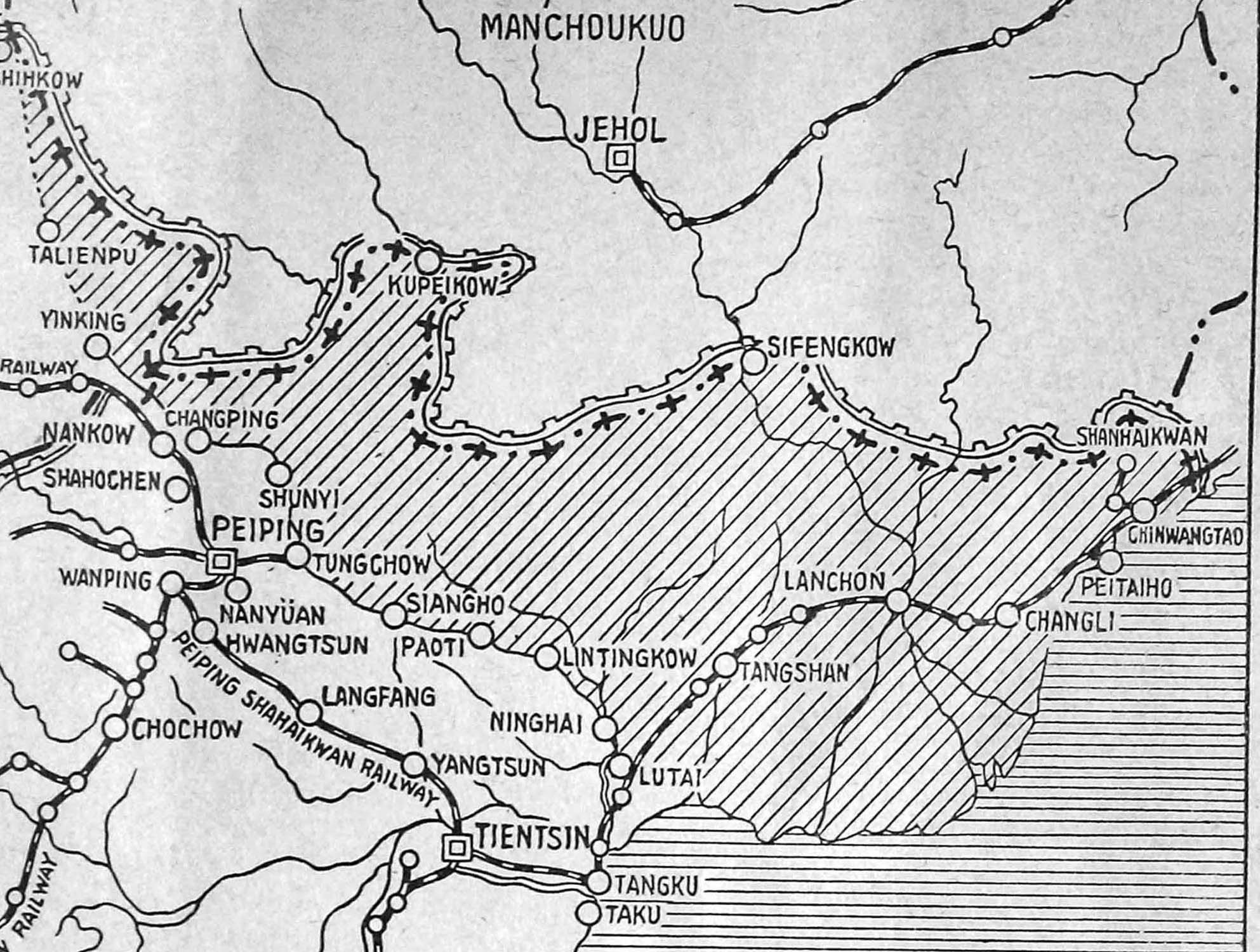
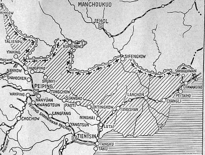
Image: Tanggu Truce Map
Size of this preview: 794 × 600 pixels. Other resolutions: 318 × 240 pixels | 1,985 × 1,500 pixels.
Original image (1,985 × 1,500 pixels, file size: 403 KB, MIME type: image/jpeg)
Description: The shaded part of this map shows the areas demilitarized by the Tanggu Truce. Note also that the remainder of the Hebei Province, including Beijing and Tianjin, would also be demilitarized of Nationalist forces under the terms of the He-Umezu Agreement, but independent warlords like Song Zheyuan continued to operate there.
Title: Tanggu Truce Map
Credit: a pamphlet called "Sino-Japanese Conflict Elucidated"
Author: Canadian Japanese Association
Usage Terms: Public domain
License: Public domain
Attribution Required?: No
Image usage
The following page links to this image:

All content from Kiddle encyclopedia articles (including the article images and facts) can be freely used under Attribution-ShareAlike license, unless stated otherwise.