
Image: Taupo.Volcanic.Zone.North.Island.NZ
Size of this preview: 427 × 599 pixels. Other resolutions: 171 × 240 pixels | 616 × 864 pixels.
Original image (616 × 864 pixels, file size: 104 KB, MIME type: image/jpeg)
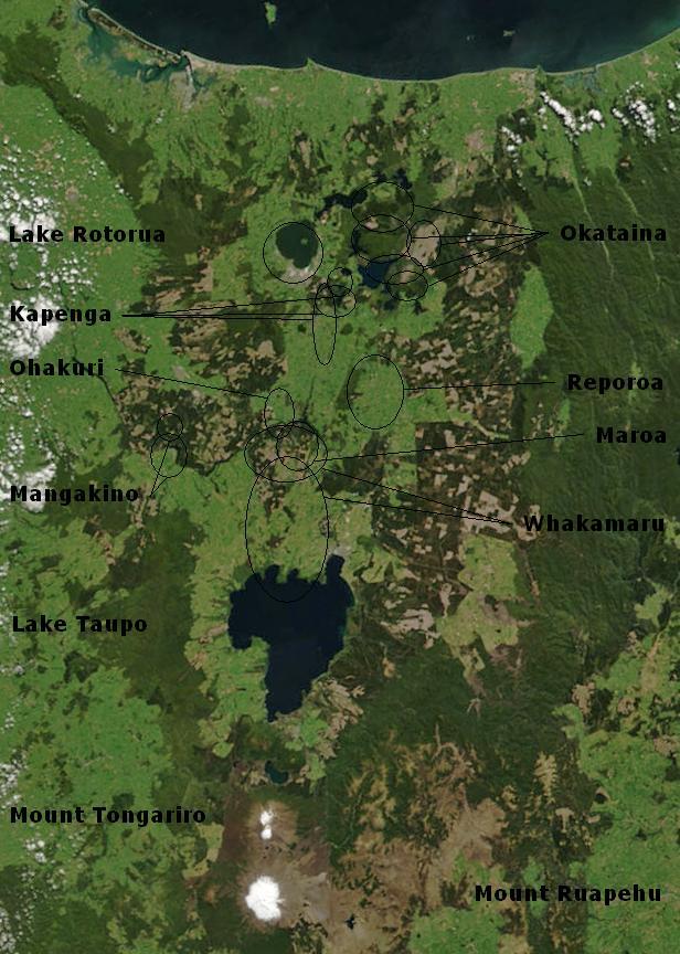
Description: Bay of Plenty, North Island, New Zealand, from the Bay of Plenty coast to Mounts Tongariro, Ngauruhoe, and Ruapehu (at bottom of picture). Also shows Lake Taupo and the Rotorua Lakes. This scene was acquired by the Moderate Resolution Imaging Spectroradiometer (MODIS), flying aboard NASA’s Terra satellite, on October 23, 2002
Title: Taupo.Volcanic.Zone.North.Island.NZ
Credit: BayofPlentyA2002296.jpg
Author: BayofPlentyA2002296.jpg: Jacques Descloitres, MODIS Rapid Response Team, NASA/GSFC derivative work: Chris.urs-o (talk)
Usage Terms: Public domain
License: Public domain
Attribution Required?: No
Image usage
The following 5 pages link to this image:

All content from Kiddle encyclopedia articles (including the article images and facts) can be freely used under Attribution-ShareAlike license, unless stated otherwise.