
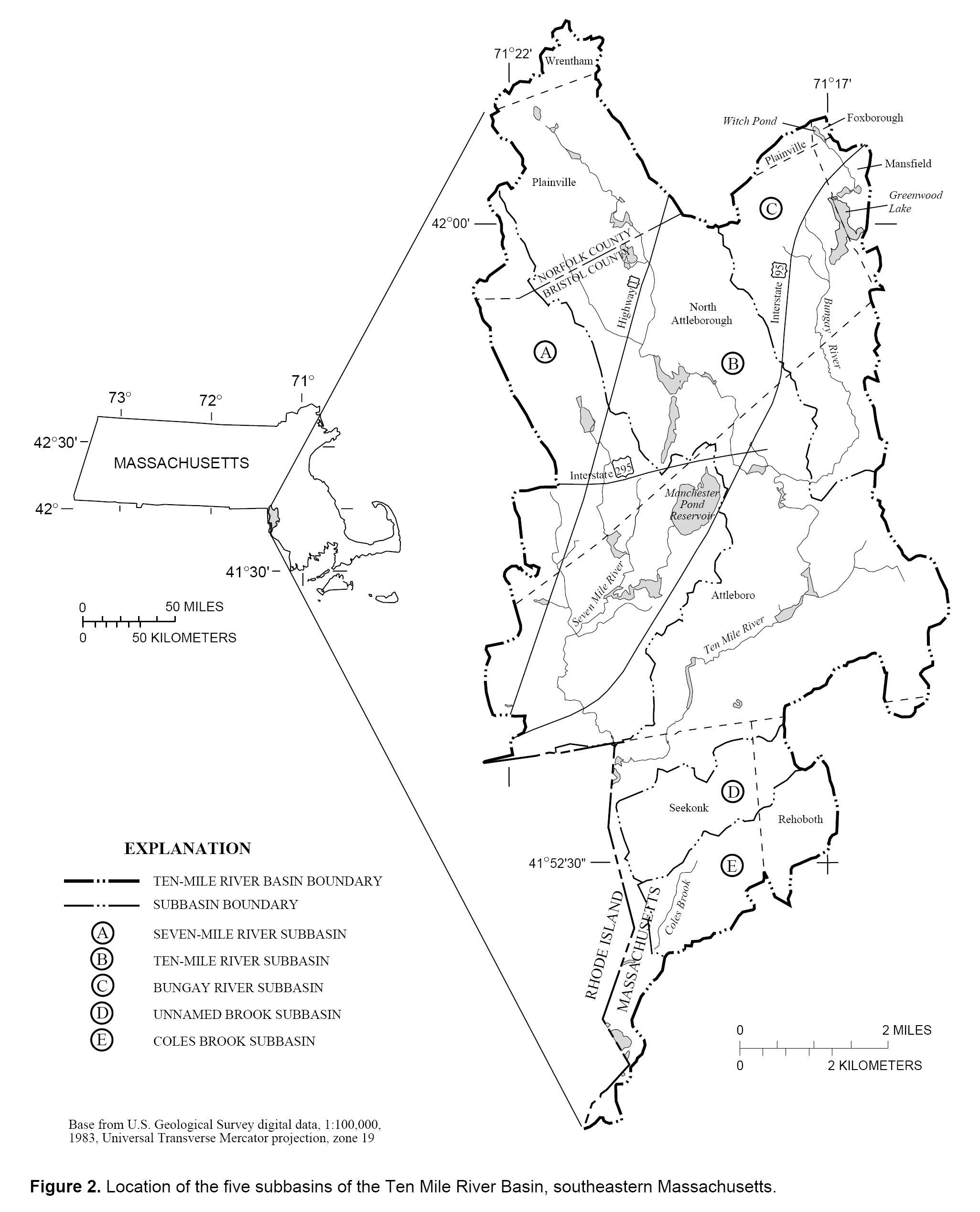
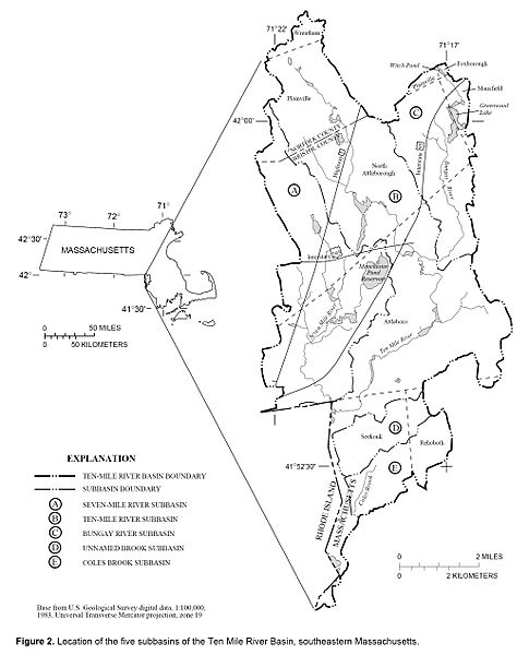
Image: Ten Mile River Basin, Massachusetts (USGS)
Size of this preview: 485 × 600 pixels. Other resolutions: 194 × 240 pixels | 2,051 × 2,536 pixels.
Original image (2,051 × 2,536 pixels, file size: 776 KB, MIME type: image/jpeg)
Description: Diagram of the Ten Mile River water basin, southeastern Massachusetts, USA.
Title: Ten Mile River Basin, Massachusetts (USGS)
Credit: M.A. Horn, "Method for Estimating Water Use and Interbasin Transfers of Freshwater and Wastewater in an Urbanized Basin", United States Geological Survey WRIR-99-4287. Figure 2. Online version at: http://pubs.usgs.gov/wri/wri994287/pdf/text2.pdf.
Author: M.A. Horn.
Permission: Public domain, as original work of the US Federal Government.
Usage Terms: Public domain
License: Public domain
Attribution Required?: No
Image usage
The following 2 pages link to this image:

All content from Kiddle encyclopedia articles (including the article images and facts) can be freely used under Attribution-ShareAlike license, unless stated otherwise.
.jpg)