
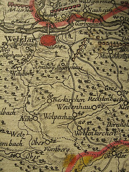
Image: Territory of Wetzlar 1760

Size of this preview: 450 × 600 pixels. Other resolutions: 180 × 240 pixels | 1,056 × 1,408 pixels.
Original image (1,056 × 1,408 pixels, file size: 1,009 KB, MIME type: image/jpeg)
Description: Territory of the Free Imperial City of Wetzlar (within the dotted line). Cropped from a French military map drawn during the Seven Years War ("Partie méridionale du Landgraviat de Hesse-Cassel avec une partie de la Vetteravie") showing parts of the Wetterau and Hesse-Cassel. Engraver: H. Cöntgen, Mainz, 1760.
Title: Territory of Wetzlar 1760
Credit: Own work
Author: Lubiesque
Usage Terms: Creative Commons Attribution-Share Alike 3.0
License: CC BY-SA 3.0
License Link: http://creativecommons.org/licenses/by-sa/3.0
Attribution Required?: Yes
Image usage
The following page links to this image:

All content from Kiddle encyclopedia articles (including the article images and facts) can be freely used under Attribution-ShareAlike license, unless stated otherwise.