
Image: The British Empire

Size of this preview: 800 × 407 pixels. Other resolutions: 320 × 163 pixels | 2,753 × 1,400 pixels.
Original image (2,753 × 1,400 pixels, file size: 411 KB, MIME type: image/png)
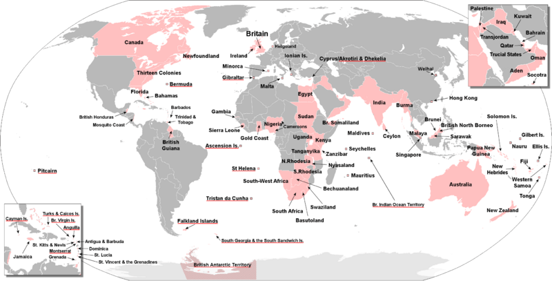
Description: The territories that were at one time or another part of the w:British Empire. The w:British Overseas Territories are underlined in red.
Title: The British Empire
Credit: File:BlankMap-World-large.png and own work by uploader. Composed from maps found in: Brown, Judith (1998) The Twentieth Century, The Oxford History of the British Empire Volume IV, Oxford University Press ISBN: 0199246793. Dalziel, Nigel (2006) The Penguin Historical Atlas of the British Empire, Penguin ISBN: 0141018445.
Author: The Red Hat of Pat Ferrick
Usage Terms: Public domain
License: Public domain
Attribution Required?: No
Image usage

All content from Kiddle encyclopedia articles (including the article images and facts) can be freely used under Attribution-ShareAlike license, unless stated otherwise.