
Image: The Carte of all the Coast of Virginia by Theodor de Bry 1585 1586
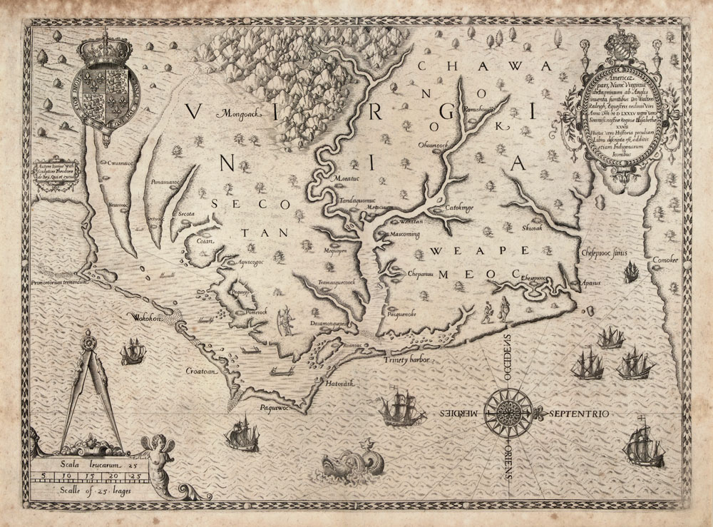
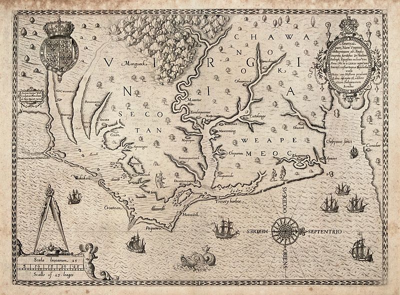
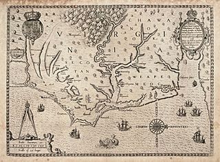
Description: "The Carte of All the Coast of Virginia," engraving by Theodor de Bry based on John White's map of the coast of Virginia and North Carolina circa 1585-1586. de Bry's engraving was published in Thomas Hariot's "A Briefe and True Report of the New Found Land of Virginia," published in 1588 and in Vol. 1 of Theodore de Bry’s Great Voyages, printed in French, English and German. This was the first printed map with a high degree of detail and accuracy for any part of the United States. It was the first separate map of Virginia. It was based on a manuscript map by John White from 1585, a copy of which is in the British Museum, revised for additional names and coastal detail gained from Roanoke Colony travels in 1587 and 1588. Quinn notes that White’s original drawing is accepted as the major contemporary authority on the configuration of the coastline in the late sixteenth century. The map was the same in all four editions of Harriot’s work. John White, one of the company sent by Sir Walter Raleigh to establish an English colony on Roanoke Island in 1585, went at least twice to the Carolina coast in the 1580s. There he produced a series of drawings of the everyday life of the Native American populations. White also compiled this map of the North Carolina coast from Cape Lookout to the mouth of the Chesapeake Bay, based on the British explorations of 1585-86, which de Bry then engraved and published in 1590.
Title: The Carte of All the Coast of Virginia
Credit: http://www.learnnc.org/lp/multimedia/6218
Author: Theodor de Bry
Usage Terms: Public domain
License: Public domain
Attribution Required?: No
Image usage
The following 3 pages link to this image:
