
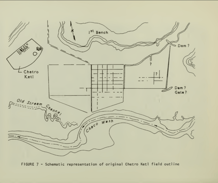
Image: The Chetro Ketl fields

Size of this preview: 713 × 600 pixels. Other resolutions: 285 × 240 pixels | 1,075 × 904 pixels.
Original image (1,075 × 904 pixels, file size: 415 KB, MIME type: image/png)
Description: This image is a NPS map of the Chetro Ketl fields.
Title: The Chetro Ketl fields
Credit: Loose, Richard W.; Lyons, Thomas R. (1976), "The Chetro Ketl Field: A Planned Water Control System in Chaco Canyon", in Lyons, Thomas R., Remote Sensing Experiments in Cultural Resource Studies: Non-destructive Methods of Archeological Exploration, Survey, and Analysis, Reports of the Chaco Center, No. 1, United States Department of the Interior, National Park Service, page 152.
Author: National Park Service
Usage Terms: Public domain
License: Public domain
Attribution Required?: No
Image usage
The following page links to this image:

All content from Kiddle encyclopedia articles (including the article images and facts) can be freely used under Attribution-ShareAlike license, unless stated otherwise.