
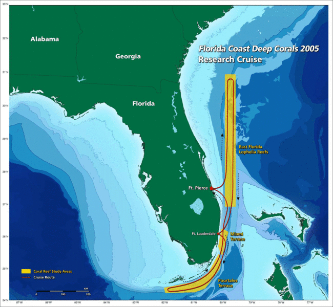
Image: The Florida straits, the L-shaped channel between southeastern Florida and the Bahamas, and the Florida Keys and Cuba

Size of this preview: 650 × 600 pixels. Other resolutions: 260 × 240 pixels | 1,300 × 1,200 pixels.
Original image (1,300 × 1,200 pixels, file size: 618 KB, MIME type: image/gif)
Description: the Florida straits, the L-shaped channel between southeastern Florida and the Bahamas, and the Florida Keys and Cuba.[1]
Title: The Florida straits, the L-shaped channel between southeastern Florida and the Bahamas, and the Florida Keys and Cuba
Credit: http://oceanexplorer.noaa.gov/explorations/05deepcorals/background/mission_plan/media/map_600.gif
Author: Image courtesy of NOAA OE.
Permission: U.S. Government work
Usage Terms: Public domain
License: PD
Attribution Required?: No
Image usage
The following page links to this image:

All content from Kiddle encyclopedia articles (including the article images and facts) can be freely used under Attribution-ShareAlike license, unless stated otherwise.