
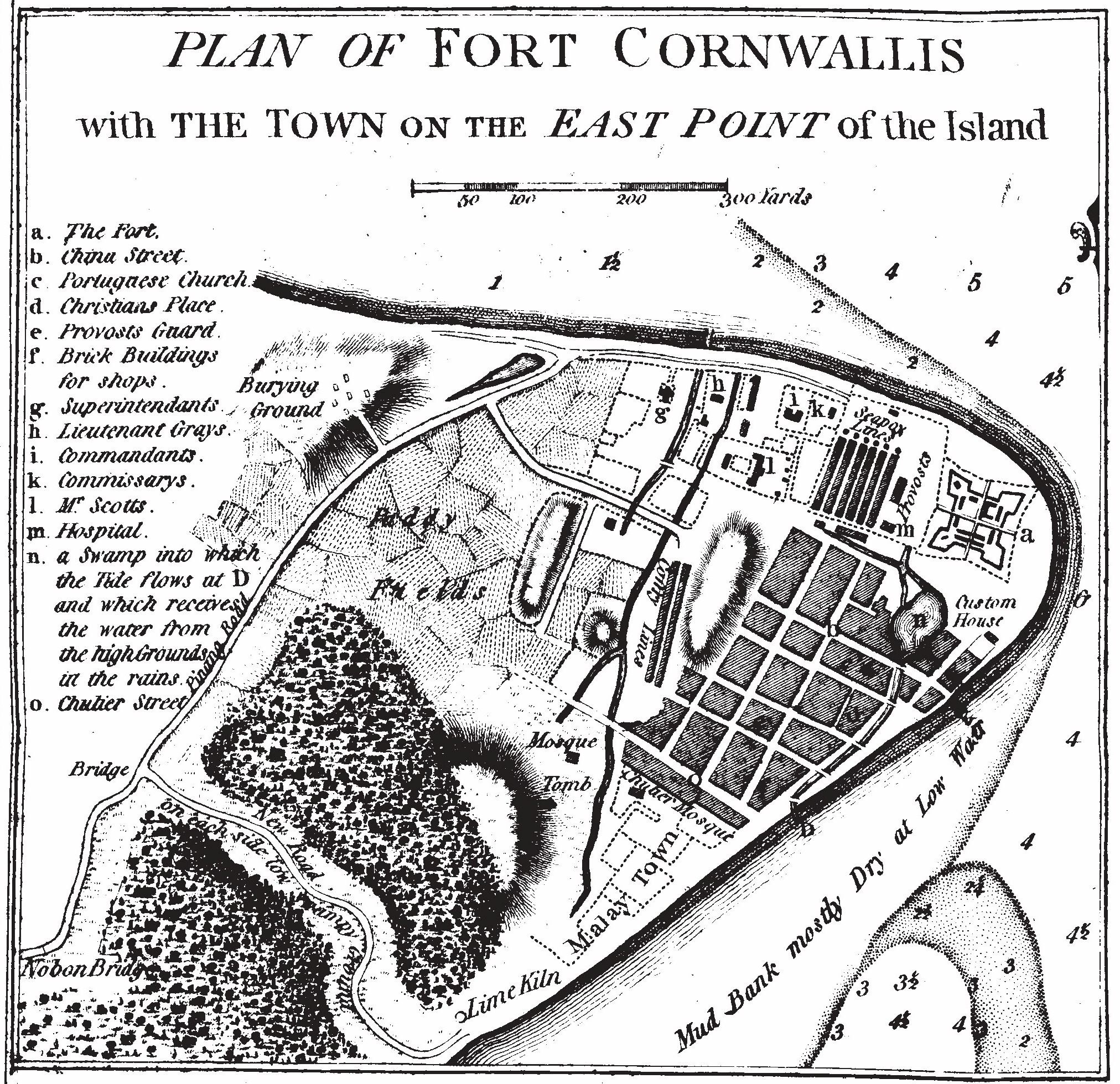
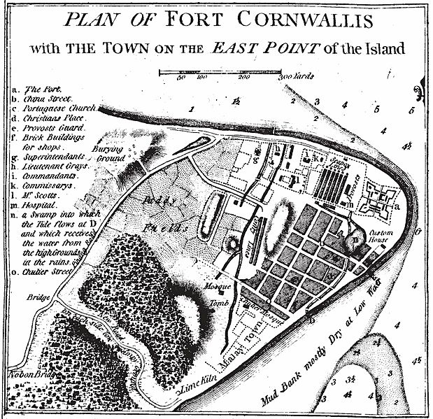
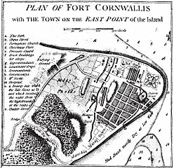
Image: The Map of Early Penang Showing the Malay Town on the South of the Town Center by Popham 1799
Size of this preview: 619 × 599 pixels. Other resolutions: 248 × 240 pixels | 2,024 × 1,960 pixels.
Original image (2,024 × 1,960 pixels, file size: 1.61 MB, MIME type: image/jpeg)
Description: The Map of Early Penang Showing the Malay Town on the South of the Town Center by Popham 1799
Title: The Map of Early Penang Showing the Malay Town on the South of the Town Center by Popham 1799
Credit: Popham, Home Riggs. Description of Prince of Wales Island in the Straits of Malacca with Its Advantages as a Marine Establishment. London.
Author: Sir Home Riggs Popham
Permission: Dominio Público por que el auto murío hace más de 70 años.
Usage Terms: Public domain
License: Public domain
Attribution Required?: No
Image usage
The following 2 pages link to this image:

All content from Kiddle encyclopedia articles (including the article images and facts) can be freely used under Attribution-ShareAlike license, unless stated otherwise.