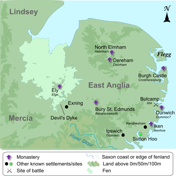
Image: The kingdom of East Anglia (Early Saxon period)

Description: Own work, map compiled from a variety of sources: http://www.english-heritage.org.uk/publications/suffolk-rczas-national-mapping-programme-report/nmpfinal02-02-05.pdf (Suffolk coast prior to reclaimation) http://www.devilsdykeproject.org.uk (Devil's Dyke) http://www.earthtools.org (Flegg and the Great Estuary) http://www.antiquemaps.com/uk/mzoom/29159.htm (Fens, pre-drainage) http://commons.wikimedia.org/wiki/File:EastAnglia.png (elevation above 50m and 100m) http://www.openstreetmap.org/ (coastline and settlements)
Title: The kingdom of East Anglia (Early Saxon period)
Credit: Transferred from en.wikipedia to Commons by Ælfgar.
Author: The original uploader was Amitchell125 at English Wikipedia
Usage Terms: Creative Commons Attribution-Share Alike 1.0
License: CC BY-SA 1.0
License Link: http://creativecommons.org/licenses/by-sa/1.0
Attribution Required?: Yes
Image usage
The following 2 pages link to this image:

