
Image: The ruined church of St Felix - geograph.org.uk - 1528057
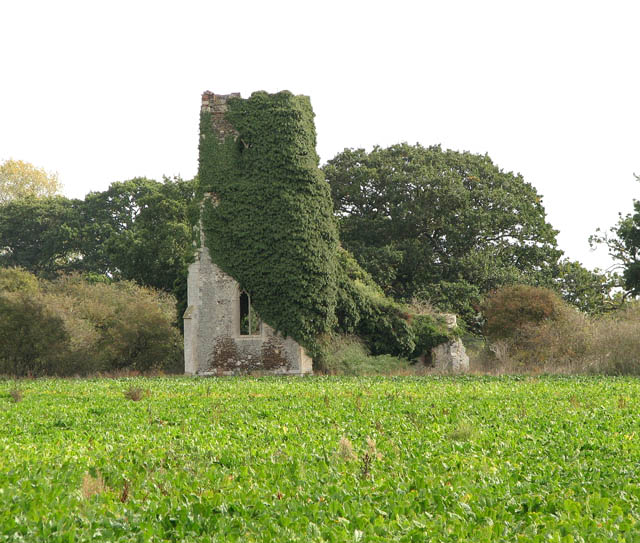
Description: The ruined church of St Felix. The church of St Felix is situated on an overgrown island surrounded by a pasture and cultivated fields. The church once used to be adjoined by the now lost village of Babingley > 1528048. It fell into disrepair, perhaps due to its isolated location, and despite attempts to salvage what was left during the 19th century the building was soon abandoned for good. Closer to the main road (now the A149) the Chapel of St Felix > 1528028 was built as a replacement in the 1880s but it too fell into disuse and now serves the British Orthodox community. The ruin can be reached via a footpath and a gate > 1528045 which leads across a pasture. Much of what remains of the structure - the tower, porch and outer walls - is clad in vines of ivy and the churchyard is overgrown > 1528054. The nave, which at some stage was completely blocked off from the chancel by a still intact wall > 1528074 with a window in it (perhaps to be used for some other purpose for some time) is clear of vegetation and the south aisle arcade > 1528070 is still in place, as are two ornate wall recesses > 1528066 at the east end. Trees are growing in the chancel > 1528083 and there is a large gap in the north wall and where the east window used to be. Babingley is one of several locations claiming that the landfall of St Felix happened here (on the occasion of the saint's invitation by the Wuffings, the then East Anglian royal family).
Title: The ruined church of St Felix - geograph.org.uk - 1528057
Credit: From geograph.org.uk
Author: Evelyn Simak
Usage Terms: Creative Commons Attribution-Share Alike 2.0
License: CC BY-SA 2.0
License Link: https://creativecommons.org/licenses/by-sa/2.0
Attribution Required?: Yes
Image usage
The following page links to this image:
