
Image: The wall of Clarence Graving Docks - geograph.org.uk - 1707965
No higher resolution available.
The_wall_of_Clarence_Graving_Docks_-_geograph.org.uk_-_1707965.jpg (640 × 480 pixels, file size: 101 KB, MIME type: image/jpeg)
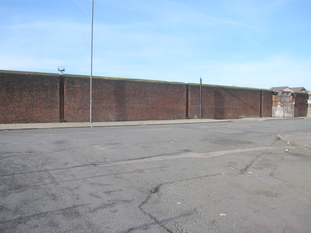
Description: The wall of Clarence Graving Docks Looking across Regent Road towards the wall of Clarence Graving Docks. Before 1957 this unspectacular view would have been enhanced by the presence of the Liverpool Overhead Railway and the Clarence Dock station, which stood above the height of the dock wall. The vertical channels in the wall are where the supports for the railway were located.
Title: The wall of Clarence Graving Docks - geograph.org.uk - 1707965
Credit: From geograph.org.uk
Author: John S Turner
Usage Terms: Creative Commons Attribution-Share Alike 2.0
License: CC BY-SA 2.0
License Link: https://creativecommons.org/licenses/by-sa/2.0
Attribution Required?: Yes
Image usage
The following page links to this image:

All content from Kiddle encyclopedia articles (including the article images and facts) can be freely used under Attribution-ShareAlike license, unless stated otherwise.