
Image: Thraciae-veteris-typvs
Size of this preview: 780 × 600 pixels. Other resolutions: 312 × 240 pixels | 4,452 × 3,424 pixels.
Original image (4,452 × 3,424 pixels, file size: 3.59 MB, MIME type: image/jpeg)
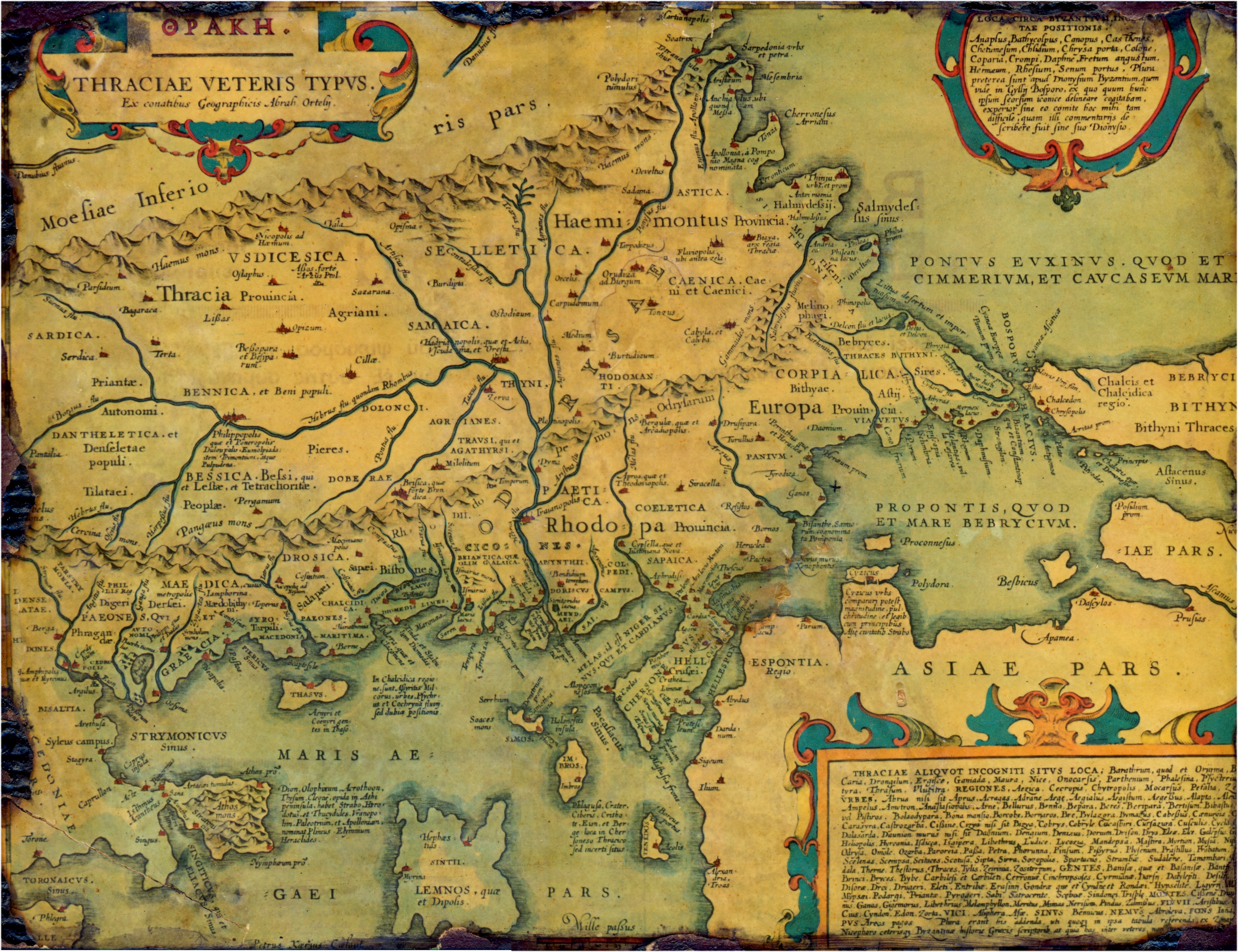
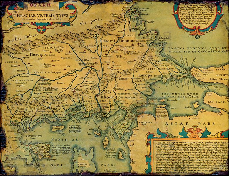
Description: Old, historical map of ancient Thrace, mostly in Latin and very few Greek, made in 1585. The map also shows part of Asia minor, Moesia inferior, & ancient Greece along with some Aegan islands. There is some anachronism on the map, such as Moesia inferior and other features.
Title: Thraciae-veteris-typvs
Credit: Thraciae veteris typvs . . . 1585
Author: Abraham Ortelius
Permission: PD-Art
Usage Terms: Public domain
License: Public domain
Attribution Required?: No
Image usage
The following page links to this image:

All content from Kiddle encyclopedia articles (including the article images and facts) can be freely used under Attribution-ShareAlike license, unless stated otherwise.