
Image: Thuringische staaten1890

Size of this preview: 800 × 541 pixels. Other resolutions: 320 × 216 pixels | 4,767 × 3,222 pixels.
Original image (4,767 × 3,222 pixels, file size: 7.42 MB, MIME type: image/jpeg)
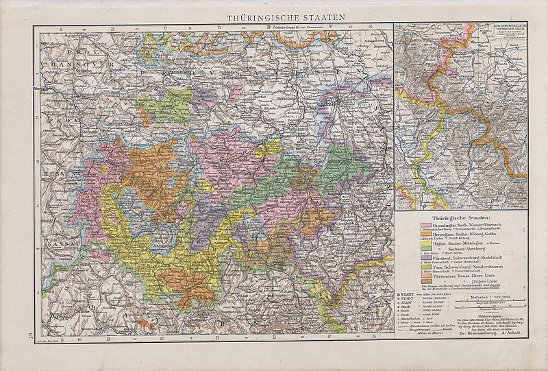
Description: Map of Thuringian States, 1890
Title: Thuringische staaten1890
Credit: Allgemeiner Handatlas : in 120 Kartenseiten nebst alphabetischem Namenverzeichnis / hrsg. von der geographischen Anstalt von Velhagen & Klasing in Leipzig, 2.,verm. und verb. Aufl., 2. rev. Abdruck, Erschienen: Bielefeld u. Leipzig : Velhagen & Klasing, 1890, S. 36.
Author: Andree, Richard
Usage Terms: Public domain
License: Public domain
Attribution Required?: No
Image usage
The following page links to this image:

All content from Kiddle encyclopedia articles (including the article images and facts) can be freely used under Attribution-ShareAlike license, unless stated otherwise.