
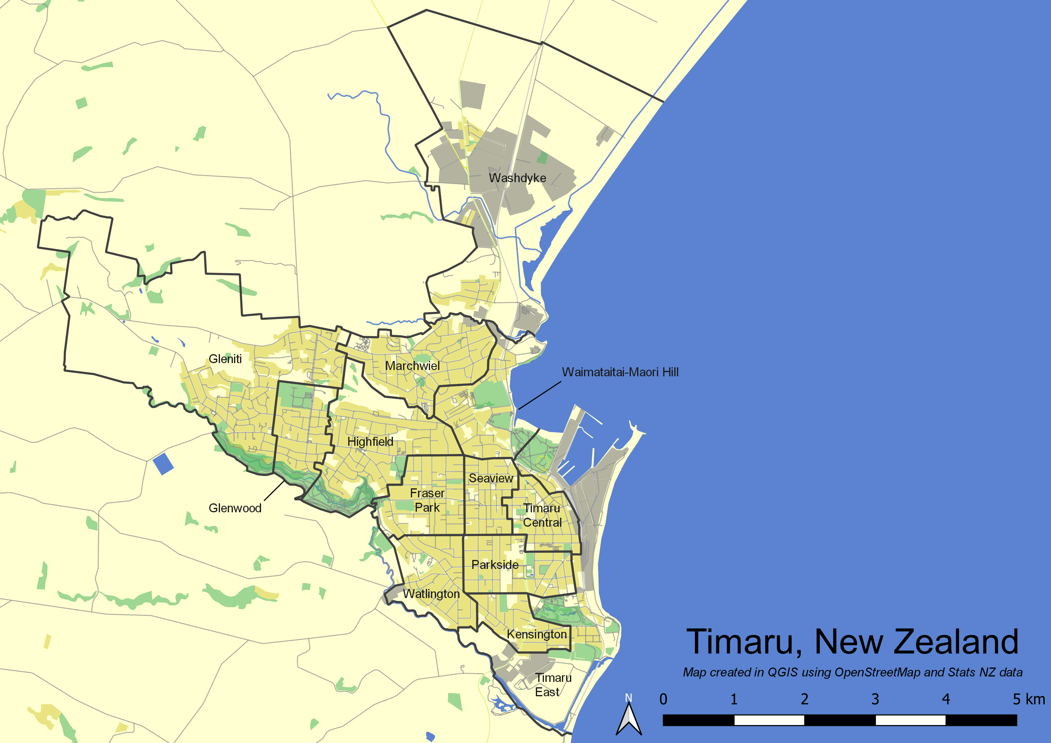
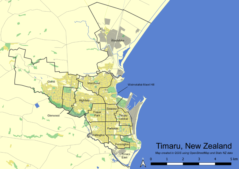
Image: Timaru suburb map
Description: Map of Timaru, Canterbury, New Zealand. 5b83d1: waterways, bodies of water, ocean e9e481: commercial, retail, residential, etc 9ed693: parks, recreation, etc b3b3a0: industrial various other colors: roads and railways Also with borders and labels of suburbs (grouped Statistical Area 2s). Data sources: https://datafinder.stats.govt.nz/layer/92212-statistical-area-2-2018-generalised/ (Stats NZ Statistical Area 2 2018 (generalized); Creative Commons Attribution 4.0 International) https://download.geofabrik.de/australia-oceania/new-zealand.html (New Zealand OpenStreetMap data; Open Data Commons Open Database License)
Title: Timaru suburb map
Credit: Own work
Author: 20UF6
Usage Terms: Creative Commons Attribution-Share Alike 4.0
License: CC BY-SA 4.0
License Link: https://creativecommons.org/licenses/by-sa/4.0
Attribution Required?: Yes
Image usage
The following page links to this image:
