
Image: Tokyo L7 lrg
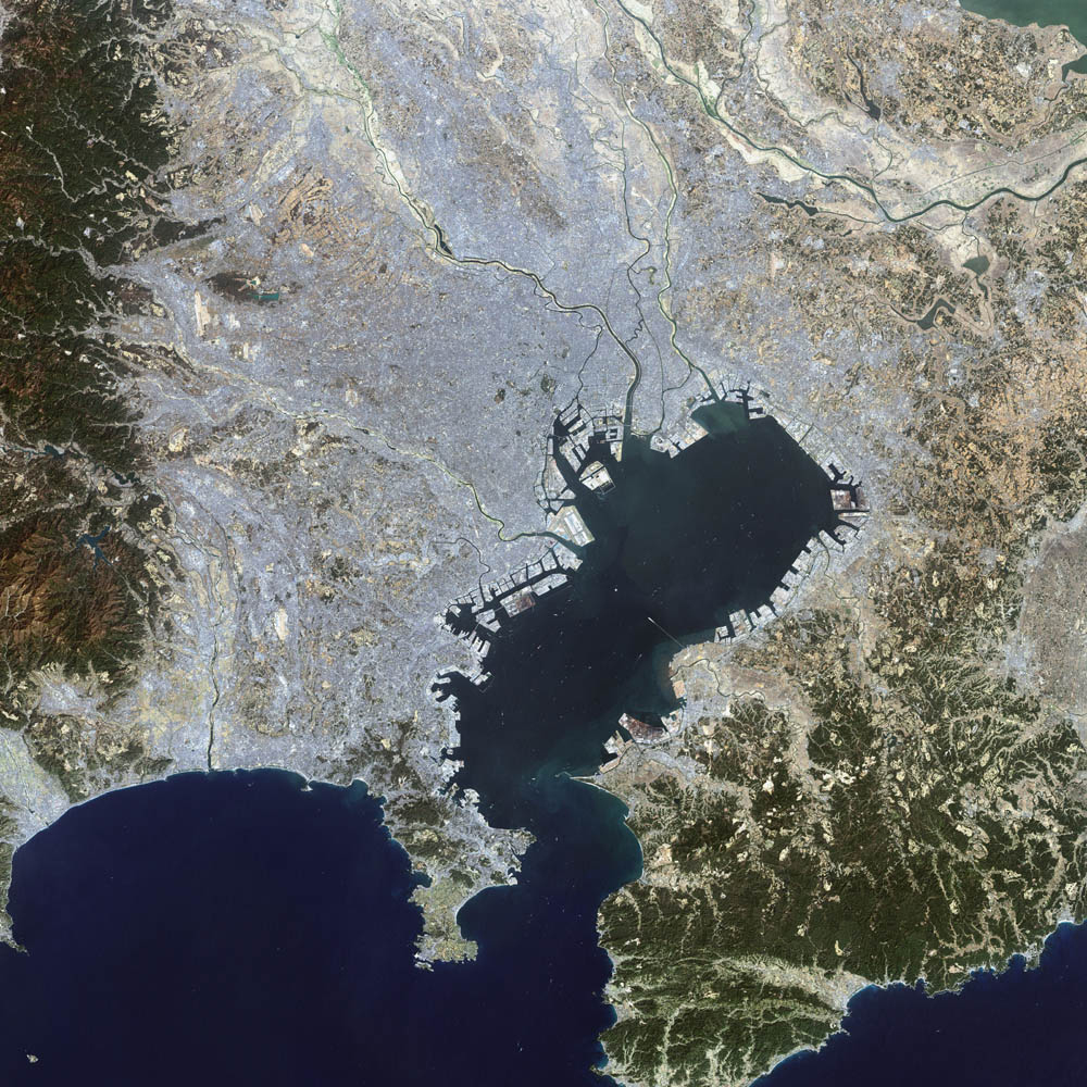
Description: This false-color Landsat 7 image shows (a large part of) the greater Tokyo metropolitan area, situated on the eastern shore of the Japanese island of Honshu. The large Tokyo Bay dominates the center of this scene, and if you look closely you can see boats and their wakes on the water. The greater Tokyo area fans out in a crescent shape around the western, northern, and eastern shores of Tokyo Bay. Greater Tokyo is bordered to the west by rugged mountains and to the east by the vast expanse of the Pacific Ocean. The greater metropolis area is comprised of Tokyo prefecture, situated on the northwestern shore of Tokyo Bay, and the three neighboring prefectures of Kanagawa to the south, Saitama to the north, and Chiba to the east and southeast across Tokyo Bay. Over the last 400 years, Japan’s National Capital Region has evolved into a large, self-governing unit consisting of 26 cities, 5 towns, and 8 villages. The region is home to some 38 million people in 2018 (more than a quarter of Japan’s whole population) in a metropolitan area spanning 14,034 square km.
Title: Tokyo L7 lrg
Credit: Earth Observatory
Author: Image courtesy Ron Beck, USGS Eros Data Center Satellite Systems Branch
Usage Terms: Public domain
License: Public domain
Attribution Required?: No
Image usage
The following page links to this image:
