
Image: Toledo, Ohio, 1876 WDL9586
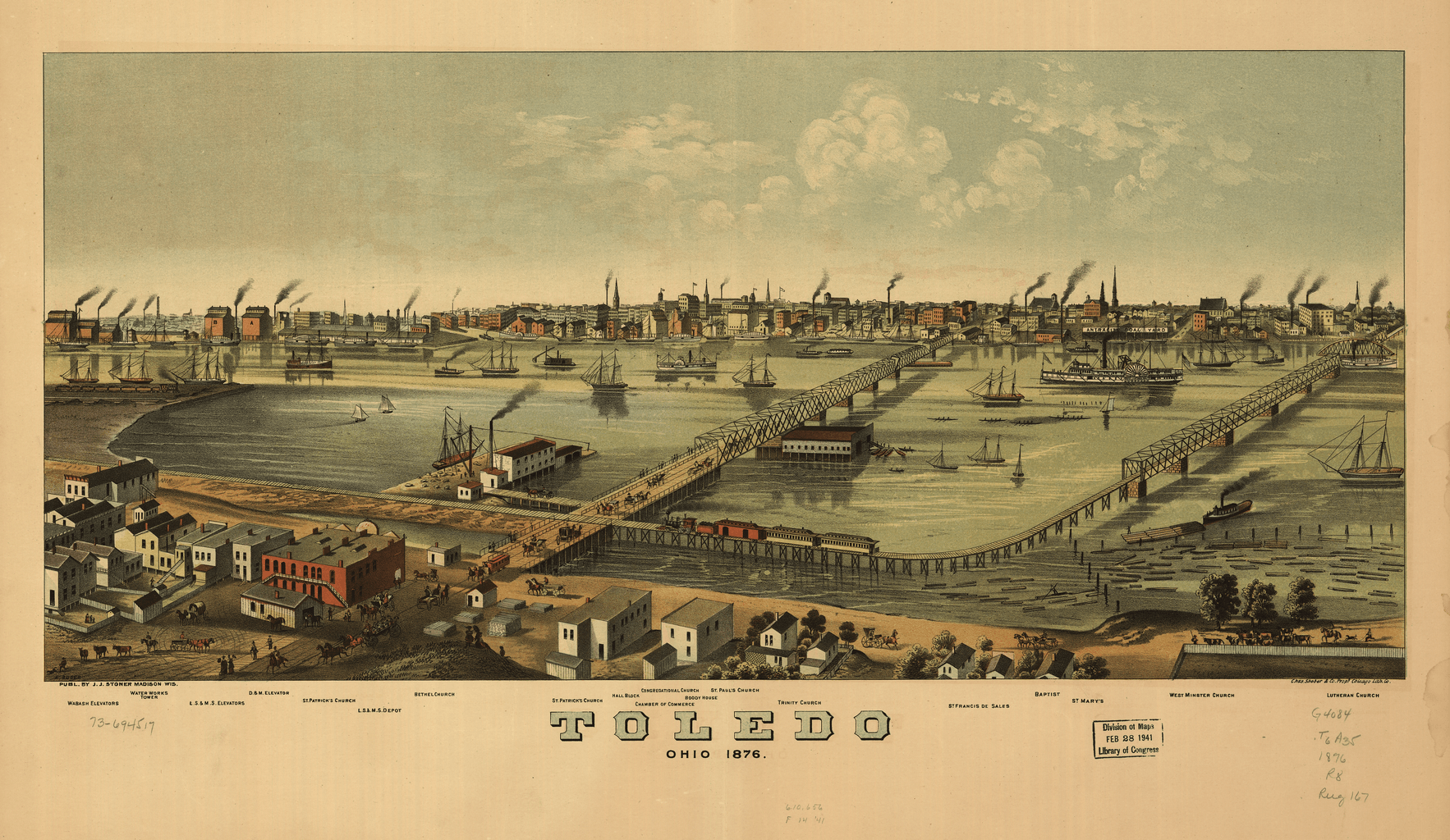
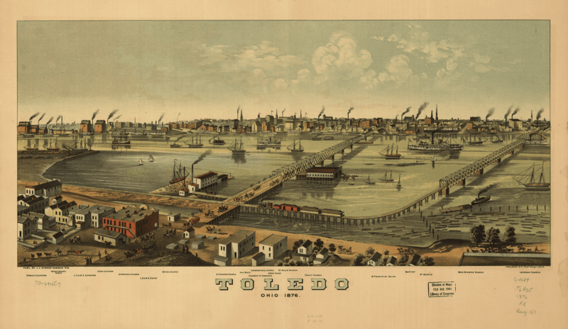
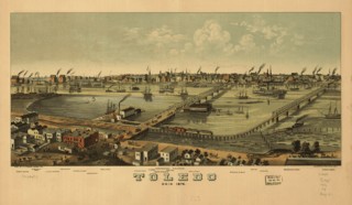
Description: This panoramic map shows Toledo, Ohio, as it appeared in 1876. Toledo is located at the western end of Lake Erie and is where the Miami and Erie Canal enters the lake. The map shows a busy harbor and major points of interest, including freight elevators, the city’s many churches, and the depot of the Lake Shore & Michigan Southern Railway, the main rail line between Chicago and Buffalo. The panoramic map was a cartographic form in popular use to depict U.S. and Canadian cities and towns in the late 19th and early 20th centuries. Also known as bird's-eye views or perspective maps, these maps are representations of cities portrayed as if viewed from above at an oblique angle. Not generally drawn to scale, they show street patterns, individual buildings, and major landscape features in perspective. This map is by Albert Ruger (1829–99), the first American to achieve success as a panoramic artist. Born in Prussia, Ruger immigrated to the United States and worked initially as a mason. While serving with the Ohio Volunteers during the Civil War, he drew views of Union campsites. After the war, Ruger settled in Battle Creek, Michigan, where he began his panoramic mapping career by sketching Michigan cities. In the late 1860s, Ruger formed a partnership with J.J. Stoner of Madison, Wisconsin, and together they published numerous city panoramas. Aerial views; Cities and towns; Erie, Lake; Harbors; Panoramic views; Railroads; Ships
Title: Toledo, Ohio, 1876
Credit: http://dl.wdl.org/9586.png Gallery: http://www.wdl.org/en/item/9586/
Author: Ruger, Albert, 1829-1899
Usage Terms: Public domain
License: Public domain
Attribution Required?: No
Image usage
The following page links to this image:
