
Image: Tombigbeerivermap

Size of this preview: 447 × 599 pixels. Other resolutions: 179 × 240 pixels | 1,360 × 1,822 pixels.
Original image (1,360 × 1,822 pixels, file size: 488 KB, MIME type: image/png)
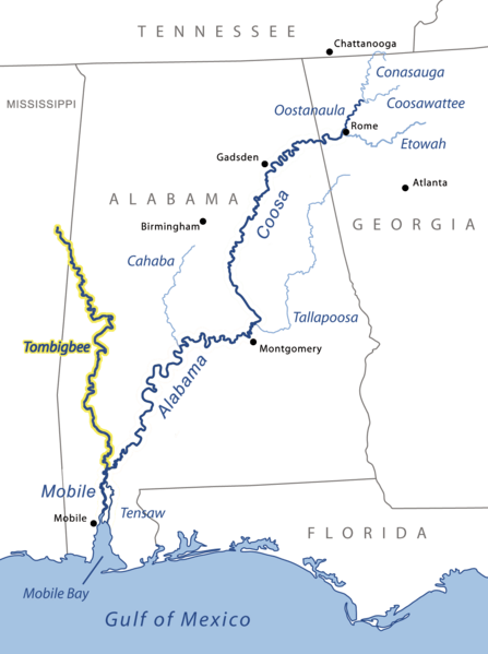
Description: Map showing the Tombigbee River, flowing from the State of Mississippi into Alabama, and joining the Alabama River. Other rivers include: the Tensaw River, Coosa River, Cahaba and Tallapoosa. Not pictured: Tennessee River and smaller rivers.
Title: Tombigbeerivermap
Credit: based on Image:MobileAlabamaCoosa3.png
Author: Kmusser
Usage Terms: Creative Commons Attribution-Share Alike 3.0
License: CC-BY-SA-3.0
License Link: http://creativecommons.org/licenses/by-sa/3.0/
Attribution Required?: Yes
Image usage
The following 2 pages link to this image:

All content from Kiddle encyclopedia articles (including the article images and facts) can be freely used under Attribution-ShareAlike license, unless stated otherwise.