
Image: Topographic map of Greenland bedrock

Size of this preview: 461 × 599 pixels. Other resolutions: 185 × 240 pixels | 802 × 1,042 pixels.
Original image (802 × 1,042 pixels, file size: 267 KB, MIME type: image/jpeg)
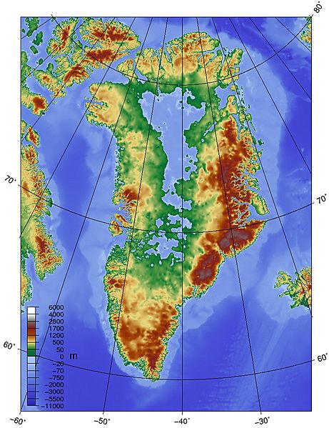
Description: Topographic map of Greenland bedrock, in effect showing the topography without the extant ice sheet. Created using ETOPO1 Global Relief Model bedrock version from [1].
Title: Topographic map of Greenland bedrock
Credit: Own work
Author: Skew-t
Usage Terms: Creative Commons Attribution-Share Alike 3.0
License: CC BY-SA 3.0
License Link: http://creativecommons.org/licenses/by-sa/3.0
Attribution Required?: Yes
Image usage
The following page links to this image:

All content from Kiddle encyclopedia articles (including the article images and facts) can be freely used under Attribution-ShareAlike license, unless stated otherwise.