
Image: Toronto map

Size of this preview: 800 × 595 pixels. Other resolutions: 320 × 238 pixels | 1,500 × 1,115 pixels.
Original image (1,500 × 1,115 pixels, file size: 703 KB, MIME type: image/png)
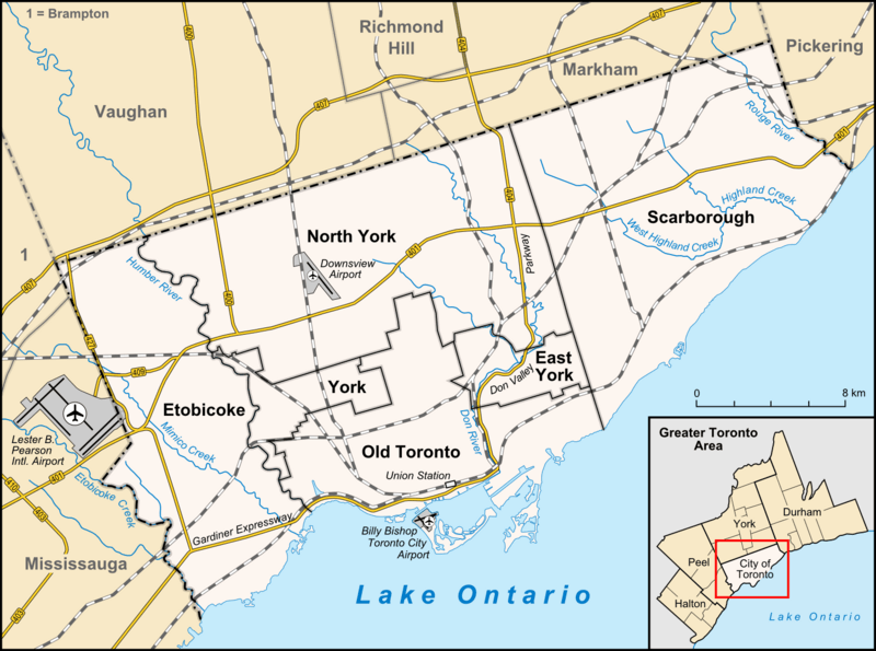
Description: Map of Toronto Geographic limits of the map: N: 43.8754583° S: 43.5655833° W: -79.6763555° E: -79.0993611° ratio of height of image to width = 0.74375
Title: Toronto map
Credit: own work, used: OpenStreetMap http://www.toronto.ca/demographics/profiles_map_and_index.htm minimap created with Greater toronto area map-de.svg by NordNordWest
Author: Lencer
Usage Terms: Creative Commons Attribution-Share Alike 3.0
License: CC BY-SA 3.0
License Link: http://creativecommons.org/licenses/by-sa/3.0
Attribution Required?: Yes
Image usage
The following 31 pages link to this image:
- Allenby, Toronto
- Armour Heights Field
- BMO Field
- Baby Point
- Black Creek (Toronto)
- Bonar Creek
- Burke Brook
- Castle Frank Brook
- CityPlace, Toronto
- Don River (Ontario)
- Etobicoke Creek
- Fort Rouillé
- German Mills Creek
- Highland Creek (Toronto)
- Humber River (Ontario)
- Jackson Creek (Toronto)
- Keating Channel
- Kensington Market
- L'Amoreaux
- Maple Leaf Gardens
- Mimico Creek
- New Fort York
- Old East York
- Rogers Centre
- Rouge River (Ontario)
- Russell Creek (Ontario)
- Taylor-Massey Creek
- Tomlin's Creek
- Toronto
- Toronto waterway system
- West Highland Creek

All content from Kiddle encyclopedia articles (including the article images and facts) can be freely used under Attribution-ShareAlike license, unless stated otherwise.