
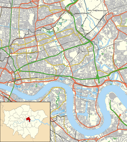
Image: Tower Hamlets London UK location map

Description: Location map of the London Borough of Tower Hamlets with the following information shown: Ward boundaries Motorways Primary routes Non-primary A roads B roads Minor roads Railways Water Woodland Buildings Equirectangular map projection on WGS 84 datum, with N/S stretched 160% Geographic limits: West: 0.085W East: 0.015E North: 51.55N South: 51.48N
Title: Tower Hamlets London UK location map
Credit: Ordnance Survey OpenData. Ward data from Boundary-Line product. All other data from VectorMap District product.
Author: Nilfanion
Permission: This file is licensed under the Creative Commons Attribution-Share Alike 3.0 Unported license. Attribution: Contains Ordnance Survey data © Crown copyright and database right You are free: to share – to copy, distribute and transmit the work to remix – to adapt the work Under the following conditions: attribution – You must attribute the work in the manner specified by the author or licensor (but not in any way that suggests that they endorse you or your use of the work). share alike – If you alter, transform, or build upon this work, you may distribute the resulting work only under the same or similar license to this one. http://creativecommons.org/licenses/by-sa/3.0 CC BY-SA 3.0 Creative Commons Attribution-Share Alike 3.0 truetrue
Usage Terms: Creative Commons Attribution-Share Alike 3.0
License: CC BY-SA 3.0
License Link: http://creativecommons.org/licenses/by-sa/3.0
Attribution Required?: Yes
Image usage
The following 4 pages link to this image:
