
Image: Tralee Ship Canal - geograph.org.uk - 268382
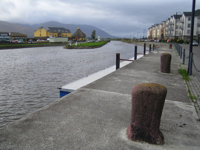
Description: Tralee Ship Canal. Blennerville was originally the port for Tralee at the mouth of the River Lee, but the estuary suffered from heavy silting. The Canal was therefore designed and built to provide access for ships directly into Tralee avoiding Blennerville and was completed in 1846. It eventually fell into disuse around 1945, but has recently been restored with new canal-frontage housing (on the right of the photo). This view was taken from the old basin at the landward end of the canal looking in the direction of the sea. The distant peaks are the Slieve Mish Mountains on the Dingle Peninsula.
Title: Tralee Ship Canal - geograph.org.uk - 268382
Credit: From geograph.org.uk
Author: Nigel Cox
Usage Terms: Creative Commons Attribution-Share Alike 2.0
License: CC BY-SA 2.0
License Link: http://creativecommons.org/licenses/by-sa/2.0
Attribution Required?: Yes
Image usage
The following 3 pages link to this image:
