
Image: Tulsa terrain

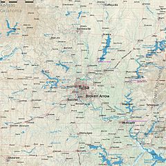
Description: Map of Tulsa, Oklahoma. Projection: WGS 84 / Pseudo Mercator, EPSG: 3857. Legend: major road minor road state boundary water river/stream dam pipeline railway aeroway power historic park/pitch/sports centre/track/golf course swimming pool cemetery construction quarry commercial industrial military residential retail amenity 0 - 150 m 150 - 200 m 200 - 250 m 250 - 300 m 300 - 350 m 350 - 400 m 400 - 450 m 450 - 500 m
Title: Tulsa terrain
Credit: Own work + SRTM from http://viewfinderpanoramas.org, Openstreetmap, Tiger, National Map Atlas, Ecoregions of Oklahoma, Lakes of Oklahoma, http://www.sourcewatch.org/index.php/Oklahoma_and_coal, Wikipedia articles, Wikidata
Author: Metropolcarte
Usage Terms: Creative Commons Attribution-Share Alike 4.0
License: CC BY-SA 4.0
License Link: http://creativecommons.org/licenses/by-sa/4.0
Attribution Required?: Yes
Image usage
The following page links to this image:
