
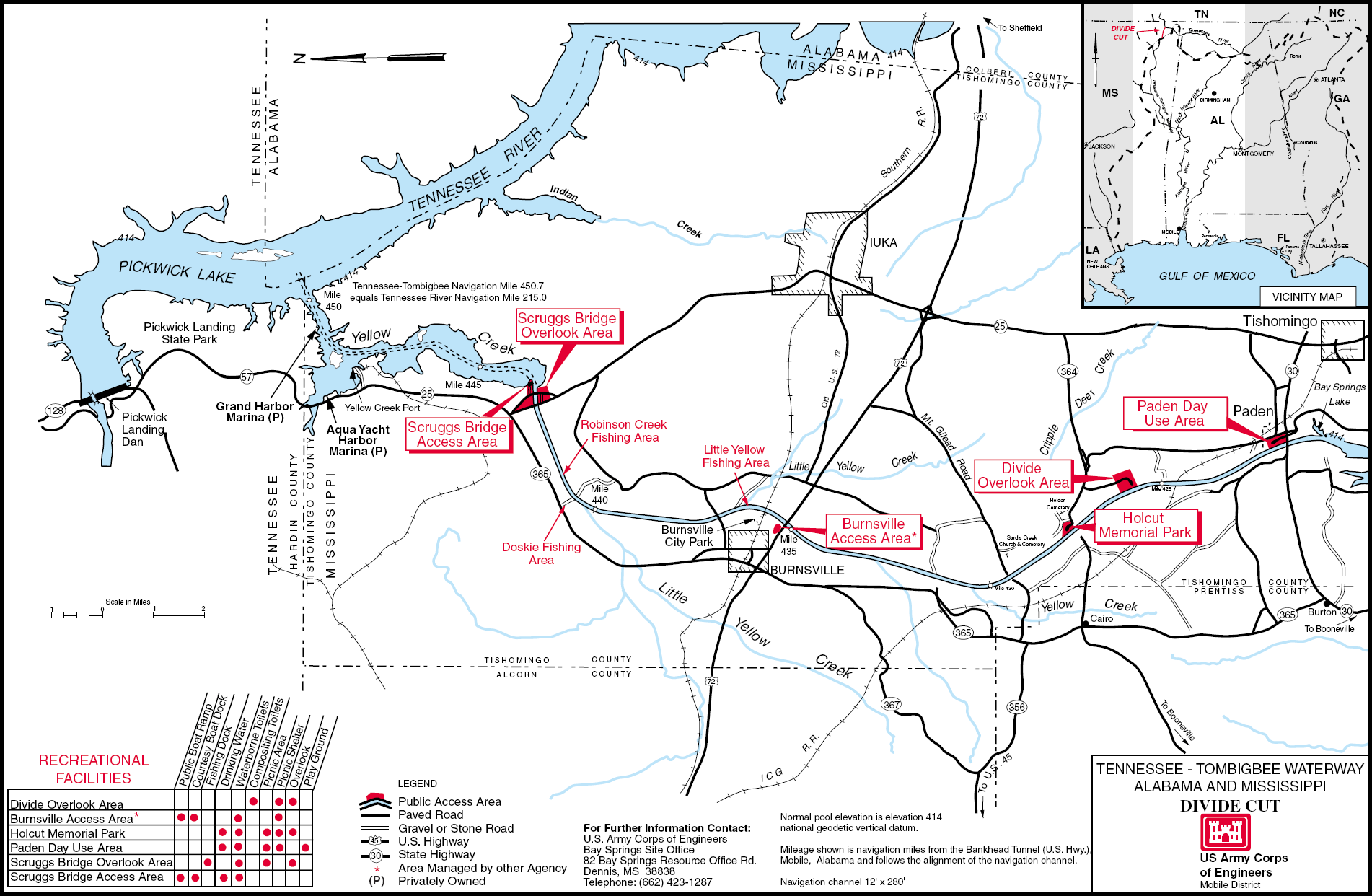
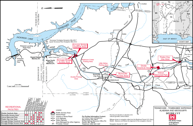
Image: USACE Divide Cut map large
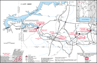
Size of this preview: 800 × 522 pixels. Other resolutions: 320 × 209 pixels | 1,902 × 1,242 pixels.
Original image (1,902 × 1,242 pixels, file size: 560 KB, MIME type: image/png)
Description: Detailed map of the Divide Cut on the Tennessee-Tombigbee Waterway in the U.S. State of Mississippi. PDF file saved as PNG.
Title: USACE Divide Cut map large
Credit: U.S. Army Corps of Engineers Image page (PDF) Map description page
Author: U.S. Army Corps of Engineers, artist not specified or unknown
Permission: This image or file is a work of a U.S. Army Corps of Engineers soldier or employee, taken or made as part of that person's official duties. As a work of the U.S. federal government, the image is in the public domain.
Usage Terms: Public domain
License: Public domain
Attribution Required?: No
Image usage
The following page links to this image:

All content from Kiddle encyclopedia articles (including the article images and facts) can be freely used under Attribution-ShareAlike license, unless stated otherwise.