
Image: USA Puerto Rico location map

Size of this PNG preview of this SVG file: 800 × 450 pixels. Other resolution: 320 × 180 pixels.
Original image (SVG file, nominally 1,058 × 595 pixels, file size: 114 KB)
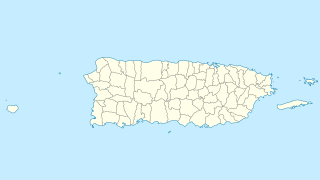
Description: Location map of Puerto Rico, USA
Title: USA Puerto Rico location map
Credit: own work, using U.S. Geological Survey (USGS) data
Author: NordNordWest
Usage Terms: Creative Commons Attribution-Share Alike 3.0
License: CC BY-SA 3.0
License Link: https://creativecommons.org/licenses/by-sa/3.0
Attribution Required?: Yes
Image usage
More than 100 pages link to this image. The following list shows the first 100 page links to this image only. A full list is available.
- Albergue Caritativo Tricoche
- Antiguo Cuartel Militar Español de Ponce
- Antiguo Hospital Militar Español de Ponce
- Arecibo Light
- Bahía de Ponce
- Bajadero, Puerto Rico
- Banco Crédito y Ahorro Ponceño (building)
- Banco de Ponce (building)
- Caguana Ceremonial Ball Courts Site
- Caja de Muertos
- Caja de Muertos Light
- Caparra Archaeological Site
- Capitol of Puerto Rico
- Cardona Island Light
- Carite Lake
- Carraízo Dam
- Casa Dra. Concha Melendez Ramirez
- Casa Fernando Luis Toro
- Casa Font-Ubides
- Casa Oppenheimer
- Casa Paoli
- Casa Salazar-Candal
- Casa Vives
- Casa Wiechers-Villaronga
- Casa del Rey
- Castillo San Felipe del Morro Lighthouse
- Castillo Serrallés
- Catedral Metropolitana Basílica de San Juan Bautista (San Juan, Puerto Rico)
- Catedral Nuestra Señora de la Candelaria (Mayagüez, Puerto Rico)
- Catedral de Nuestra Señora de Guadalupe
- Cayo Batata
- Cayo Icacos
- Cayo Luis Peña
- Cayo Norte
- Cayo Santiago
- Cayos de Caña Gorda
- Cementerio Católico San Vicente de Paul
- Cerrillos State Forest
- Cerro Maravilla
- Cerro de Punta
- Cerro del Diablo
- Cerro del Vigía
- Cordillera Central (Puerto Rico)
- Cueva del Indio
- Culebrita
- Desecheo Island
- Dos Bocas Lake
- El Tuque
- El Yunque (Puerto Rico)
- Ensenada Honda (Ceiba, Puerto Rico)
- Episcopal Cathedral of St. John the Baptist (San Juan, Puerto Rico)
- Fort Allen (Puerto Rico)
- Fortín de San Gerónimo
- Guajataca Lake
- Hacienda Lealtad
- Hacienda de Carlos Vassallo
- Icacos River
- Iglesia de la Santísima Trinidad
- Isla Cardona
- Isla Palomino
- Isla de Cabras
- Isla de Jueyes
- Isla de Mona
- Isla de Ratones (Cabo Rojo, Puerto Rico)
- Isla de Ratones (Ponce, Puerto Rico)
- Isla del Frío
- Jose V. Toledo Federal Building and United States Courthouse
- Joyuda, Puerto Rico
- Joyuda Lagoon
- La Plata Lake
- Lake Cerrillos
- Levittown, Puerto Rico
- Loíza Lake
- McCabe Memorial Church
- Mercado de las Carnes
- Monito Island
- Museo de la Masacre de Ponce
- Normandie Hotel
- Nuestra Señora de Lourdes Chapel
- Palacete Los Moreau
- Panteón Nacional Román Baldorioty de Castro
- Parque de Bombas
- Peñón de Ponce
- Plaza Colón
- Polvorín de Miraflores
- Ponce City Hall
- Ponce YMCA Building
- Portugués Dam
- Primera Iglesia Metodista Unida de Ponce
- Rafael Hernández Airport
- Residencia Aboy-Lompré
- Residencia Armstrong-Poventud
- Residencia Subirá
- Rosaly–Batiz House
- Sabana Llana Norte, San Juan, Puerto Rico
- Sabana Llana Sur, San Juan, Puerto Rico
- Stella, Puerto Rico
- Teatro Yagüez
- Tibes Indigenous Ceremonial Center
- Toro Negro State Forest

All content from Kiddle encyclopedia articles (including the article images and facts) can be freely used under Attribution-ShareAlike license, unless stated otherwise.