
Image: USGS Pine Creek Geosyncline
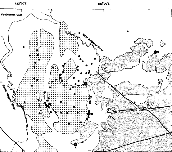
Description: USGS Precambrian geologic map of the Pine Creek Geosyncline. Uranium deposits: R=Ranger, K=Koongarra, N=Nabarlek, and J=Jabiluka. Stippling indicates the Kombolgie Formation of Middle Proterozoic sandstones with some volcanics, crosses indicate the Nanambu Complex of Archean granites and gneisses, and the unmarked outlined region indicates the Cahill Formation of Proterozoic metamorphic rocks.
Title: USGS Pine Creek Geosyncline
Credit: Calcium-Phosphorus Relationships in Unconformity-vein Uranium Deposits, Alligator Rivers Uranium Field, Australia, USGS Open-File Report 85-364
Author: David Frishman, C.J. Nutt, J. Thomas Nash, and R.I. Grauch
Usage Terms: Public domain
License: Public domain
Attribution Required?: No
Image usage
The following page links to this image:
