
Image: US Army 52415 Siege of Yorktown Map

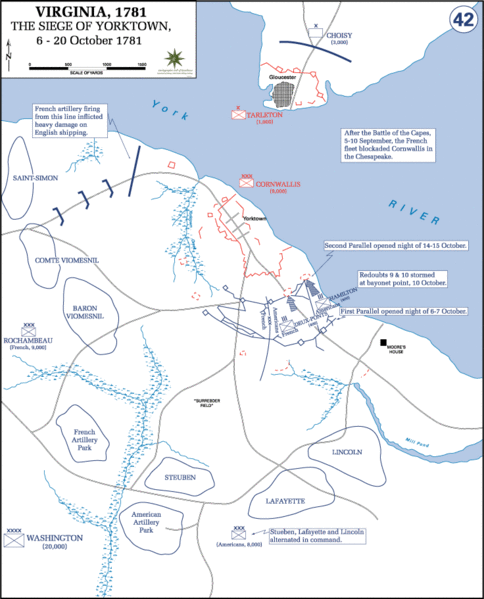
Description: Siege of Yorktown Map October 6-20, 1781: This map shows the disposition of the allied American and French forces surrounding the British army trapped at Yorktown, VA. Note the positions of Redoubts 9 and 10 in advance of the main British fortifications near the York River, and how they were incorporated into the second siege parallel. Point blank cannon fire from batteries along this siege line forced Cornwallis to surrender. NOTE: Click on the map once to obtain a larger image. (Online Atlas Collection, History Department, U.S. Military Academy at West Point).
Title: US Army 52415 Siege of Yorktown Map
Credit: United States Army
Author: U. S. Military Academy
Usage Terms: Public domain
License: Public domain
Attribution Required?: No
Image usage
There are no pages that link to this image.
