
Image: US Northeastern states

Size of this preview: 800 × 520 pixels. Other resolutions: 320 × 208 pixels | 1,513 × 983 pixels.
Original image (1,513 × 983 pixels, file size: 31 KB, MIME type: image/png)
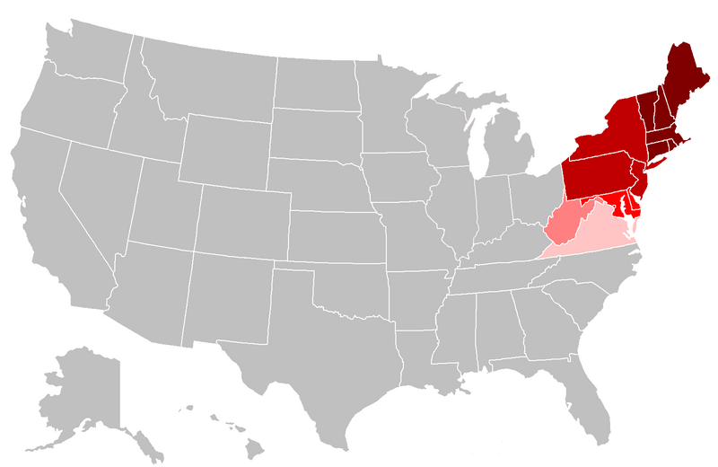
Description: Map of the northeastern United States. The pink areas include states that are cited by fewer reliable sources as being included in the Northeast. The red areas are more frequently cited by reliable sources, and the dark red are the most commonly accepted as being included in the Northeast.
Title: US Northeastern states
Credit: Own work, File:BlankMap-USA-states.PNG
Author: Grayshi, Roke, Maher-shalal-hashbaz
Usage Terms: Creative Commons Attribution-Share Alike 3.0
License: CC BY-SA 3.0
License Link: http://creativecommons.org/licenses/by-sa/3.0
Attribution Required?: Yes
Image usage
There are no pages that link to this image.

All content from Kiddle encyclopedia articles (including the article images and facts) can be freely used under Attribution-ShareAlike license, unless stated otherwise.