
Image: US Secession map 1861

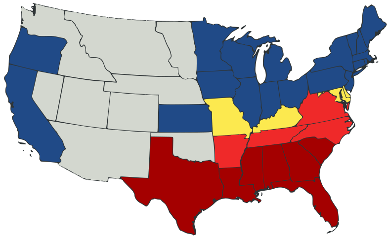
Description: United States map of 1861, show affiliation of states and territories regarding the Secession War (Civil War.) Legend: States that seceded before April 15, 1861 States that seceded after April 15, 1861 Union states that permitted slavery Union states that forbade slavery Territories, unaffiliated
Title: US Secession map 1861
Credit: The source code of this SVG is valid. This vector image was created with Inkscape, and then manually edited. A trace, retouch, and recolour of Image:Secession Map of the United States, 1861.png by User:Tomf688.
Author: Júlio Reis
Usage Terms: Creative Commons Attribution-Share Alike 3.0
License: CC BY-SA 3.0
License Link: http://creativecommons.org/licenses/by-sa/3.0
Attribution Required?: Yes
Image usage
The following 5 pages link to this image:
