
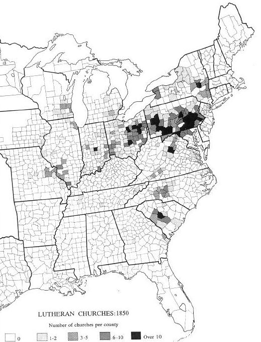
Image: US census map of Lutheran churches - 1850
Size of this preview: 458 × 599 pixels. Other resolutions: 183 × 240 pixels | 524 × 685 pixels.
Original image (524 × 685 pixels, file size: 95 KB, MIME type: image/jpeg)
Description: 1850 US census map of Lutheran churches.
Title: US census map of Lutheran churches - 1850
Credit: United States Census Office Atlas; transferred from en.wikipedia by User:Sreejithk2000 using CommonsHelper.
Author: United States Census Office (renamed the United States Census Bureau in 1903); originally uploaded to en.wikipedia by Rjensen, using a copy in Edwin Scott Gaustad, Historical atlas of religion in America (1962) p 73
Permission: PD-US.
Usage Terms: Public domain
License: Public domain
Attribution Required?: No
Image usage
The following page links to this image:

All content from Kiddle encyclopedia articles (including the article images and facts) can be freely used under Attribution-ShareAlike license, unless stated otherwise.