
Image: UTEP and border aerial Dec 2017

Size of this preview: 356 × 599 pixels. Other resolutions: 143 × 240 pixels | 1,512 × 2,542 pixels.
Original image (1,512 × 2,542 pixels, file size: 3.67 MB, MIME type: image/jpeg)
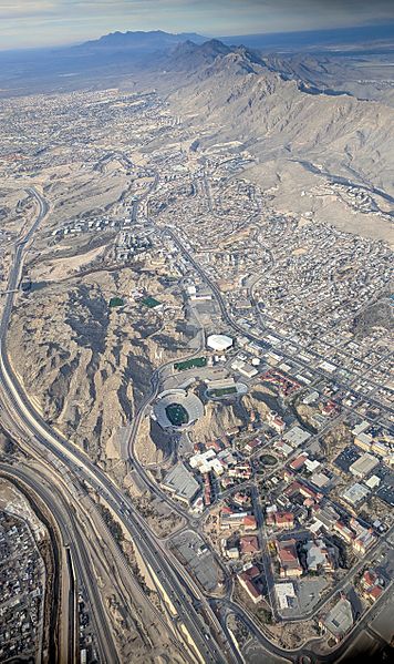
Description: Aerial view of the entire UTEP campus, situated between the US–Mexico border at lower left and the west side and Franklin Mountains of El Paso at the upper right. The Organ Mountains near Las Cruces, New Mexico, are visible in the distance.
Title: UTEP and border aerial Dec 2017
Credit: Own work
Author: Dicklyon
Usage Terms: Creative Commons Attribution-Share Alike 4.0
License: CC BY-SA 4.0
License Link: https://creativecommons.org/licenses/by-sa/4.0
Attribution Required?: Yes
Image usage
The following page links to this image:

All content from Kiddle encyclopedia articles (including the article images and facts) can be freely used under Attribution-ShareAlike license, unless stated otherwise.