
Image: Udmap
Size of this preview: 570 × 599 pixels. Other resolutions: 228 × 240 pixels | 780 × 820 pixels.
Original image (780 × 820 pixels, file size: 151 KB, MIME type: image/jpeg)
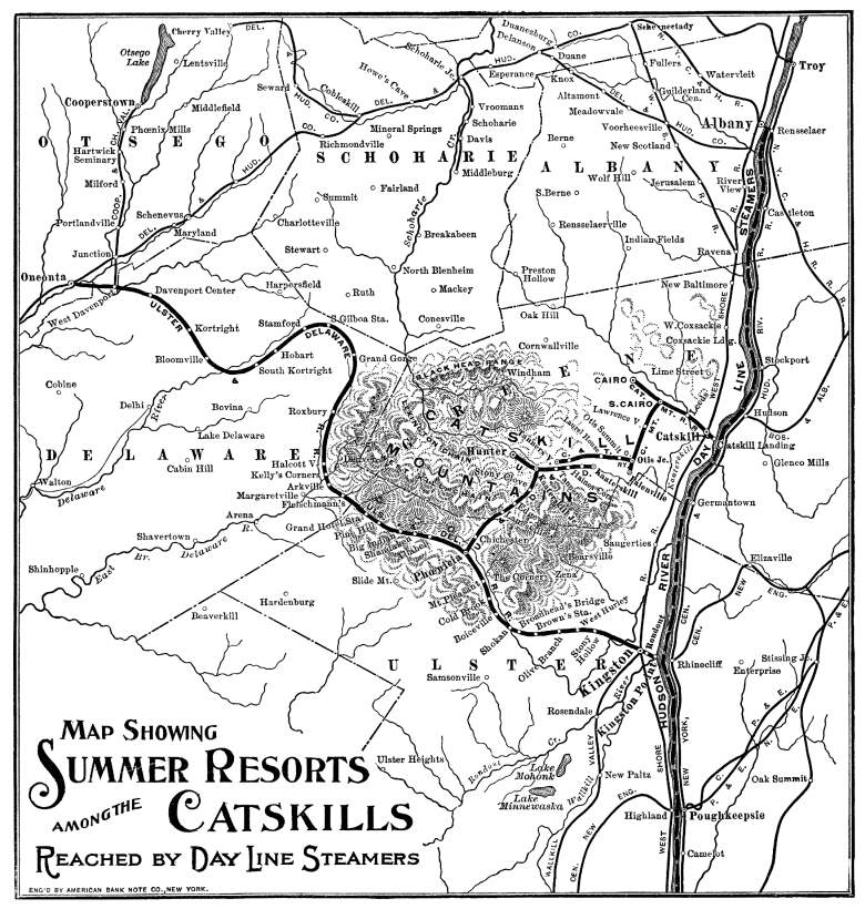
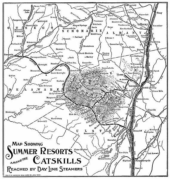
Description: A map of the railroads in the Catskill Mountains. Despite what the map says, nearly the entirety of this map is of the Catskills. East of the Hudson River are The Berkshires and the Taconic Mountains, and to the far north (central and northern Albany County, and far northern Schoharie County) are the Appalachians.
Title: Udmap
Credit: Digital reproduction or scan of original map. Under US laws mechanical reproduction of a work does not create an additional copyright to that of the original.
Usage Terms: Public domain in the United States
License: PD-US
License Link: //en.wikipedia.org/wiki/File:Udmap.jpg
Image usage
The following page links to this image:

All content from Kiddle encyclopedia articles (including the article images and facts) can be freely used under Attribution-ShareAlike license, unless stated otherwise.