
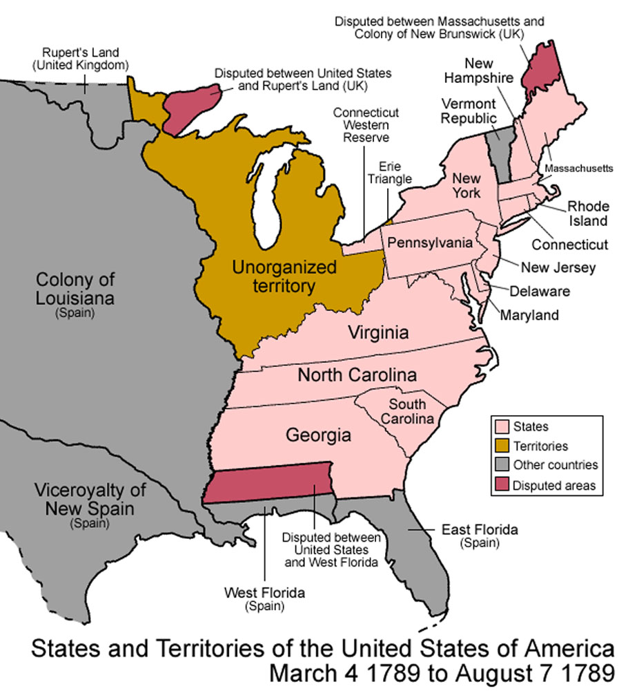
Image: United States 1789-03 to 1789-08 eastern
Size of this preview: 538 × 600 pixels. Other resolutions: 215 × 240 pixels | 897 × 1,000 pixels.
Original image (897 × 1,000 pixels, file size: 159 KB, MIME type: image/jpeg)
Description: Map of the states and territories of the United States as it was from March 1789 to August 1789.
Title: United States 1789-03 to 1789-08 eastern
Credit: sub area of File:United States 1789-03-1789-08.png plus my modifications (cropped to show eastern half, one label moved from cropped area to visible area)
Author: author of source image, plus my modifications (myself)
Permission: same permission as original image (see below)
Usage Terms: Creative Commons Attribution 2.5
License: CC BY 2.5
License Link: https://creativecommons.org/licenses/by/2.5
Attribution Required?: Yes
Image usage
There are no pages that link to this image.

All content from Kiddle encyclopedia articles (including the article images and facts) can be freely used under Attribution-ShareAlike license, unless stated otherwise.