
Image: United States 1804-10-1805-01
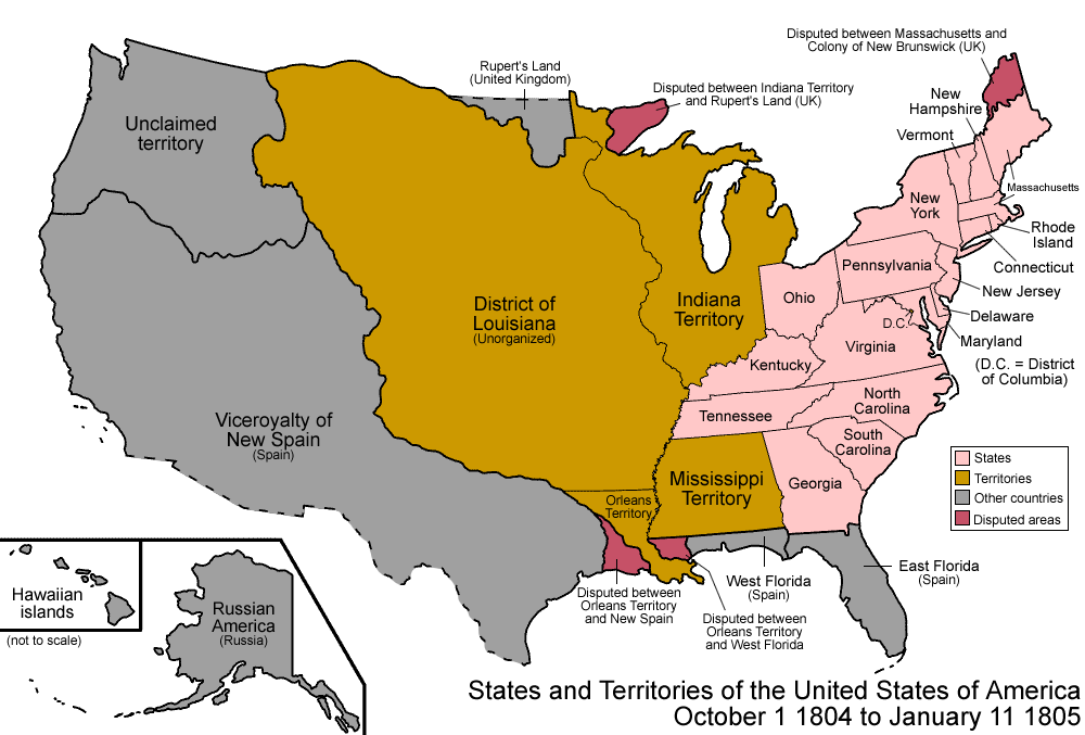
Description: Map of the states and territories of the United States as it was from October 1804 to January 1805. On October 1 1804, the Louisiana Purchase was designated the District of Louisiana, with a small portion organized as Orleans Territory; this portion included a region disputed with New Spain. On January 11 1805, Michigan Territory was split from Indiana Territory.
Title: United States 1804-10-1805-01
Credit: Own work
Author: Made by User:Golbez.
Permission: Own work, attribution required (Multi-license with GFDL and Creative Commons CC-BY 2.5)
Usage Terms: Creative Commons Attribution 2.5
License: CC BY 2.5
License Link: https://creativecommons.org/licenses/by/2.5
Attribution Required?: Yes
Image usage
The following 5 pages link to this image:
