
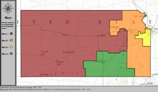
Image: United States Congressional Districts in Kansas, 1993 – 2002

Description: Statewide boundaries for United States congressional districts in Kansas, 1993 – 2002. Map color key is provided inside the image.
Title: United States Congressional Districts in Kansas, 1993 – 2002
Credit: US Department of the Interior, public data retrieved from http://cdmaps.polisci.ucla.edu on October 18, 2014.
Author: Authors: 1) All GIS data presented in this project was originally collected and published by the United States Department of the Interior. 2) US district GIS shapefile data created in association with the UCLA by Jeffrey B. Lewis, Brandon DeVine, Lincoln Pitcher, and Kenneth C. Martis. (2013) Digital Boundary Definitions of United States Congressional Districts, 1789-2012. 3) Data was rendered using ArcGIS® software by Esri. 4) File developed for use on Wikipedia and elsewhere by 7partparadigm.
Usage Terms: Public domain
License: Public domain
Attribution Required?: No
Image usage
The following page links to this image:
