
Image: United States Louisiana Purchase states

Size of this preview: 800 × 525 pixels. Other resolutions: 320 × 210 pixels | 904 × 593 pixels.
Original image (904 × 593 pixels, file size: 20 KB, MIME type: image/png)
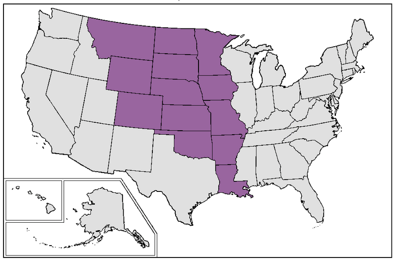
Description: Map of current US states that were completely or mostly located inside the borders of old colonial French Louisiana at the time of Louisiana Purchase by the United States in 1803.
Title: United States Louisiana Purchase states
Credit: Derived from File:Map of USA-bw.png, which is based on File:Map of USA.png.
Author: MaGioZal, based on an image by Wikimedia Commons user Brianski, which is itself based on an image by Wikimedia Commons user Roke and Wikimedia Commons user Brianski.
Usage Terms: Creative Commons Attribution-Share Alike 3.0
License: CC-BY-SA-3.0
License Link: http://creativecommons.org/licenses/by-sa/3.0/
Attribution Required?: Yes
Image usage
The following page links to this image:

All content from Kiddle encyclopedia articles (including the article images and facts) can be freely used under Attribution-ShareAlike license, unless stated otherwise.