
Image: Urritiamapoftubac
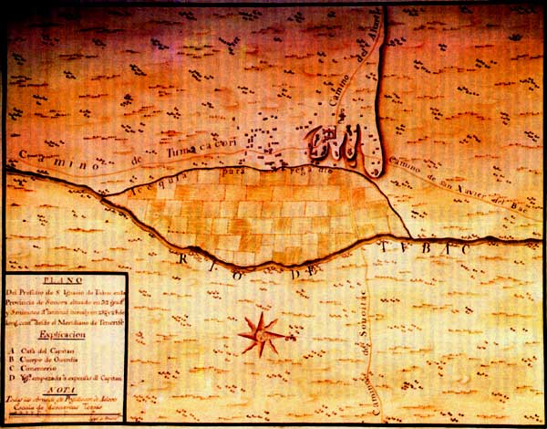
Description: Urrutia Map of Tubac: December 1766—January 1767 A Spanish colonial era map locating San Ignacio de Tubac Presidio in the northern Viceroyalty of New Spain (Colonial México). The present-day Tubac Presidio State Historic Park in Tubac, Arizona.
Title: Urritiamapoftubac
Credit: [1] (University of Arizona)
Author: Unknown
Permission: This file is in the public domain, because The creator died and the work was published more than 80 years ago in Spain, per Commons:Licensing#Spain. In case this is not legally possible: The right to use this work is granted to anyone for any purpose, without any conditions, unless such conditions are required by law. Please verify that the reason given above complies with Commons' licensing policy.
Usage Terms: Public domain
License: Public domain
Attribution Required?: No
Image usage
The following 4 pages link to this image:
