
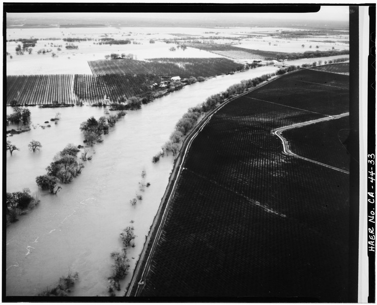
Image: VIEW TO SOUTHEAST. AERIAL VIEW OF AREA DURING FLOOD STAGE. GIANELLA BRIDGE AT UPPER RIGHT Photographer unknown, January 24, 1970 - Gianella Bridge, Spanning Sacramento River HAER CAL,11-HAMCI.V,1-33
Size of this JPG preview of this TIF file: 741 × 600 pixels. Other resolution: 297 × 240 pixels.
Original image (5,000 × 4,048 pixels, file size: 19.31 MB, MIME type: image/tiff)
Title: VIEW TO SOUTHEAST. AERIAL VIEW OF AREA DURING FLOOD STAGE. GIANELLA BRIDGE AT UPPER RIGHT Photographer unknown, January 24, 1970 - Gianella Bridge, Spanning Sacramento River at State Highway 32, Hamilton City, Glenn County, CA
Credit: http://www.loc.gov/pictures/item/ca1372.photos.011081p
Permission: This image or media file contains material based on a work of a National Park Service employee, created as part of that person's official duties. As a work of the U.S. federal government, such work is in the public domain in the United States. See the NPS website and NPS copyright policy for more information.
Usage Terms: Public domain
License: Public domain
Attribution Required?: No
Image usage
There are no pages that link to this image.

All content from Kiddle encyclopedia articles (including the article images and facts) can be freely used under Attribution-ShareAlike license, unless stated otherwise.