
Image: Van Buren County Michigan 1906 Almena Township
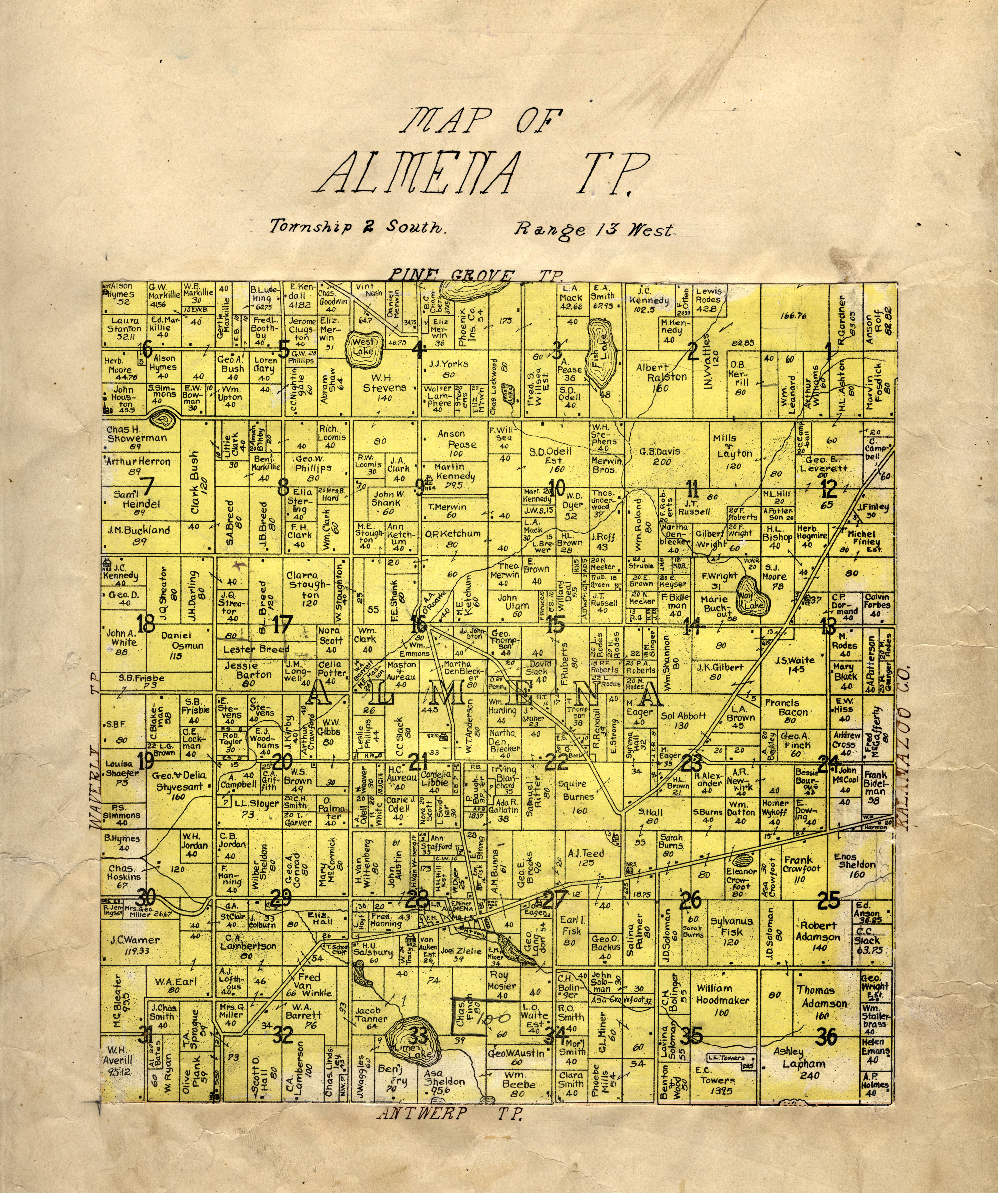
Description: Digital scan of the Almena Township portion of a larger 1906 map of Van Buren County, Michigan. The county map was cut into township-sized pieces, and the pieces were later found pasted into an 1895 atlas of Van Buren County, now in the collection of the Michigan State University Map Library. Each township map cut from the 1906 county map was pasted onto a blank page opposite the map of the corresponding township in the 1895 county atlas. Shows parcel boundaries and names of property owners, Public Land Survey System township and section numbering, roads, railroads, residences, schools, churches, municipalities, and water features. Print version was cut from map: Orton, M. K. A farm map of Vanburen County, Michigan / compiled from official records and local inspection by W.H. Goss, County Surveyor ; drawn by M.K. Orton. Rockford, Ill. : W.W. Hixson, [1906]. MSU Libraries catalog record: http://catalog.lib.msu.edu/record=b12060606~S39a
Title: Van Buren County Michigan 1906 Almena Township
Credit: http://www.lib.msu.edu/branches/map/MiJPEGs/6_g1413v3k3_1895_l/
Author: Compiled from official records and local inspection by W.H. Goss, County Surveyor. Drawn by M.K. Orton.
Usage Terms: Public domain
License: Public domain
Attribution Required?: No
Image usage
The following page links to this image:
