
Image: Vancouver Island contour map
Size of this preview: 598 × 600 pixels. Other resolutions: 239 × 240 pixels | 640 × 642 pixels.
Original image (640 × 642 pixels, file size: 196 KB, MIME type: image/png)
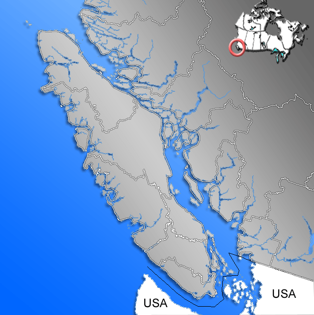
Description: Contour of Vancouver Island with Regional Districts
Title: Vancouver Island contour map
Credit: GIS data
Author: Qyd
Permission: All
Usage Terms: Public domain
License: Public domain
Attribution Required?: No
Image usage
The following 31 pages link to this image:
- Bainbridge Lake
- Brewster Lake
- Buttle Lake
- Cameron Lake (British Columbia)
- Campbell River (Vancouver Island)
- Comox Lake
- Cowichan Lake
- Devils Den Lake
- Elkhorn Mountain
- Esary Lake
- Gabriola Island
- Golden Hinde (mountain)
- Great Central Lake
- Henderson Lake (British Columbia)
- John Hart Lake
- Kennedy Lake (Vancouver Island)
- Lacy Lake
- Lizard Lake (Juan de Fuca, Vancouver Island)
- Lower Campbell Lake
- Lowry Lake
- McCoy Lake
- Nanaimo Lakes
- Oshinow Lake
- Port San Juan
- Quamichan Lake
- Quennell Lake
- Shawnigan Lake
- Somenos Lake
- Sooke Lake
- Sproat Lake
- Upper Campbell Lake

All content from Kiddle encyclopedia articles (including the article images and facts) can be freely used under Attribution-ShareAlike license, unless stated otherwise.