
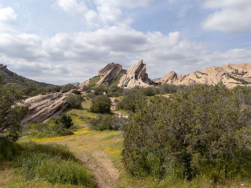
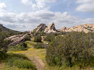
Image: Vasquez Rocks chaparral

Description: I played hooky for a mid-week sojourn to view the California Super Bloom without the overwhelming crowds. There were still a LOT of people, but the flowers were beautiful! I started out with a scenic drive to Carrizo Plain National Monument, wandered over to the Antelope Valley California Poppy Reserve State Natural Reserve, and wrapped up the day with a hike in Vasquez Rocks Natural Area Park. The Carrizo Plain is a large enclosed grassland plain, approximately 50 miles (80 km) long and up to 15 miles (24 km) across, in southeastern San Luis Obispo County, California, about 100 miles (160 km) northwest of Los Angeles. It contains the 246,812-acre (99,881 ha) Carrizo Plain National Monument, and it is the largest single native grassland remaining in California. It includes Painted Rock in the Carrizo Plain Rock Art Discontiguous District, which is listed on the National Register of Historic Places. In 2012 it was further designated a National Historic Landmark due to its archeological value. The San Andreas Fault cuts across the plain. Antelope Valley California Poppy Reserve is a state-protected reserve of California, USA, harboring the most consistent blooms of California poppies, the state flower. The reserve is located in the rural west side of Antelope Valley in northern Los Angeles County, 15 miles (24 km) west of Lancaster. The reserve is at an elevation ranging from 2,600 to 3,000 feet (790 to 910 m) above sea level, in the Mojave Desert climate zone. The reserve is administered by the California Department of Parks and Recreation. Other wildflowers within the reserve include the owl's clover, lupine, goldfields, cream cups and coreopsis. Vasquez Rocks Natural Area Park is a 932-acre (377-hectare) park located in the Sierra Pelona Mountains in northern Los Angeles County, California. It is located in the town of Agua Dulce, between the suburbs of Santa Clarita and Palmdale. The area is also visible from the Antelope Valley Freeway (State Route 14).
Title: Vasquez Rocks chaparral
Credit: https://www.flickr.com/photos/ruggybear/48000799482/
Author: Matthew Dillon
Usage Terms: Creative Commons Attribution 2.0
License: CC BY 2.0
License Link: https://creativecommons.org/licenses/by/2.0
Attribution Required?: Yes
Image usage
The following page links to this image:
